- Handmade locally. No import duty or tax
- FREE worldwide delivery
- Love it or your money back (90 days)
- Questions? WhatsApp me any time
Own a piece of history
5,000+ 5 star reviews


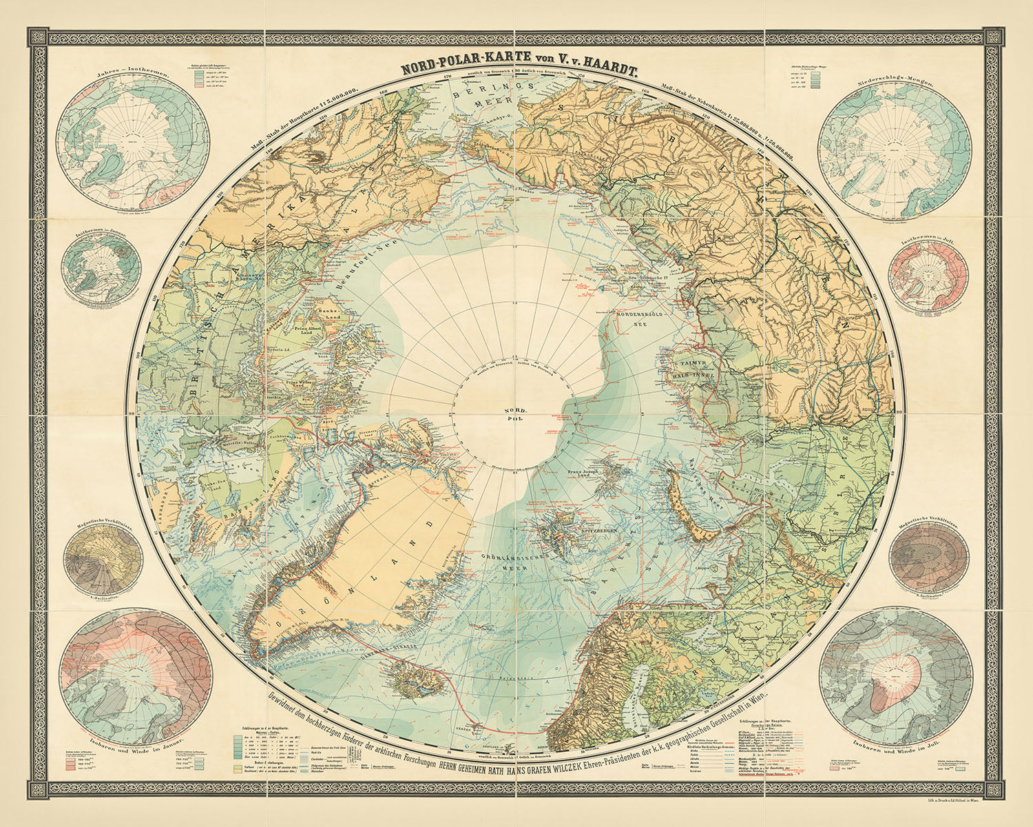
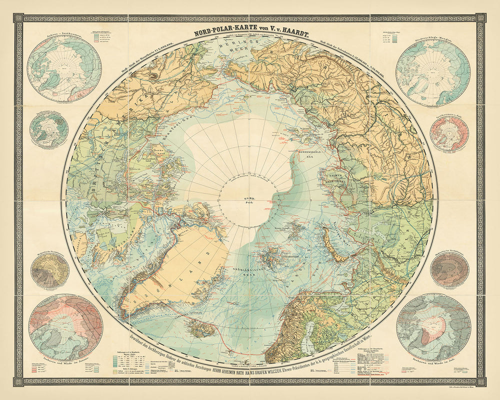
Step into the annals of Arctic exploration with the "Nord Polar Karte von V. v. Haardt," a remarkable cartographic masterpiece created by Vincenz von Haardt von Hartenthurn in 1898. This exquisite map, published by E. Hoelzel in Vienna, stands as the most comprehensive wall map of Arctic exploration from the 19th century. It chronicles the relentless pursuit of the North Pole, capturing the essence of human curiosity and the indomitable spirit of explorers who ventured into the unknown. The map's historical significance is underscored by its creation less than a decade before the North Pole was finally reached, making it a testament to the culmination of centuries of exploration.
The map meticulously traces the evolution of Arctic exploration, beginning with Martin Frobisher's voyages in the late 16th century (1576-78) and extending through the daring expeditions of the late 19th century. It highlights the journeys of legendary explorers such as Willem Barents in 1594, Henry Hudson in 1607, and Alexander Mackenzie in 1789. The 19th century is particularly well-represented, showcasing pivotal expeditions like those of John Franklin in 1826 and Frederick William Beechey. The inclusion of Fridtjof Nansen and Otto Sverdrup's expeditions in 1895, as well as the ill-fated Andrée's Arctic balloon expedition of 1897, adds depth to the narrative of exploration.
A unique feature of this map is its incorporation of extensive scientific data, reflecting the empirical and intellectual traditions of the time. Influenced by figures like the Humboldt brothers, the map provides detailed observations on ice coverage, ocean currents, temperature variations, and magnetic fields. This scientific rigor offers a comprehensive view of the North Polar regions as understood at the brink of the 20th century, making it not only a historical document but also a valuable scientific resource.
The map's design is both functional and aesthetically pleasing, featuring eight thematic insets that provide additional layers of information. These insets, positioned clockwise from the upper right, include data on precipitation, isotherms in July, magnetic conditions, and isobars and winds in July. The chromolithographed style adds a vibrant and detailed visual appeal, making it a striking piece for any collection. The map also systematically records the progress of Arctic exploration, with labeled routes and significant places where important events occurred, such as the paths taken by the "Fox" in 1858 and the "Helgoland" in 1898.
The "Nord Polar Karte von V. v. Haardt" is not just a map; it is a historical artifact that encapsulates the fervor and determination of Arctic explorers. It offers a window into the past, allowing us to trace the footsteps of those who braved the icy wilderness in search of new frontiers. This map is a rare find, with only a handful of institutional examples recorded, making it a coveted piece for collectors and historians alike. Its rich historical context and detailed representation of Arctic exploration make it a timeless treasure, worthy of admiration and study.
Places on this map
- Greenland
- Iceland
- Spitzbergen (Svalbard)
- Franz Josef Land
- Novaya Zemlya
- Siberia
- Alaska
- Canada
- Baffin Bay
- Hudson Bay
- Barents Sea
- Kara Sea
- Laptev Sea
- East Siberian Sea
- Chukchi Sea
- Bering Strait
- Beaufort Sea
- Ellesmere Island
- Victoria Island
- Wrangel Island
Notable Features & Landmarks
- Martin Frobisher's voyages (1576-78)
- Willem Barents' expedition (1594)
- Henry Hudson's exploration (1607)
- Alexander Mackenzie's journey (1789)
- Sir Edward Parry's expeditions (1821-22)
- John Franklin's expedition (1826)
- Frederick William Beechey's voyage
- Peary's expeditions (1891-92, 1895)
- Fridtjof Nansen and Otto Sverdrup's expeditions (1895)
- Andrée's Arctic balloon expedition (1897)
- "Balaena" expedition (1897)
- "Helgoland" journey (1898)
- Routes taken by "Fox" (1858)
- "Rescue" (1851)
- "Resolute" (1855)
- Hall's expedition (1860-62)
- "Hope" (1897)
- Dease & Simpson (1839)
- Collinson's winter routes (1852-53, 1853-54)
- McClure's winter route (1850-51)
- Richardson's journey (1848)
- Pullen's route (1849)
- Kellett's route (1849)
- Berry's route ("Rodgers") (1881)
- Onatzewitsch's route (1876)
- Kotzebue's expedition (1816)
- Wrangell's journey (1823)
- De Long's route (1867)
- Kosmin's route (1823)
- Anjou's expedition (1822)
- Untergang's route ("Jeannette") (1881)
- Nansen and Johannesen's route (1895)
- Sverdrup's route ("Fram") (1895)
- Weyprecht and Payer's journey (1873-74)
- Jackson's expedition (1894-96)
- Leigh Smith's route (1881)
- Pike's route ("Victoria") (1897)
- Kukenthal's journey (1889)
Historical and design context
- Name of the map: Nord Polar Karte von V. v. Haardt
- Date of creation: 1898
- Mapmaker/Publisher: Vincenz von Haardt von Hartenthurn, published by E. Hoelzel in Vienna
- Historical significance: The most comprehensive wall map of Arctic exploration of the 19th century, published less than a decade before the North Pole was reached.
- Scientific significance: Features detailed scientific observations such as ice coverage, ocean currents, temperature variations, and magnetic fields.
- Exploratory significance: Chronicles the history of Arctic exploration from the late 16th century to contemporary expeditions of the late 19th century.
- Topics and themes shown on the map: Arctic exploration, scientific data, and significant expeditions.
- Design and style: Chromolithographed wall map with eight thematic insets showing precipitation, isotherms in July, magnetic conditions, and isobars and winds in July.
- Historical context: Maps out the routes taken by various explorers over the centuries, reflecting the empirical and intellectual traditions of the time.
Please double check the images to make sure that a specific town or place is shown on this map. You can also get in touch and ask us to check the map for you.
This map looks great at every size, but I always recommend going for a larger size if you have space. That way you can easily make out all of the details.
This map looks amazing at sizes all the way up to 100in (250cm). If you are looking for a larger map, please get in touch.
Please note: the labels on this map are hard to read if you order a map that is 36in (90cm) or smaller. The map is still very attractive, but if you would like to read the map easily, please buy a larger size.
The model in the listing images is holding the 16x20in (40x50cm) version of this map.
The fifth listing image shows an example of my map personalisation service.
If you’re looking for something slightly different, check out my collection of the best old maps to see if something else catches your eye.
Please contact me to check if a certain location, landmark or feature is shown on this map.
This would make a wonderful birthday, Christmas, Father's Day, work leaving, anniversary or housewarming gift for someone from the areas covered by this map.
This map is available as a giclée print on acid free archival matte paper, or you can buy it framed. The frame is a nice, simple black frame that suits most aesthetics. Please get in touch if you'd like a different frame colour or material. My frames are glazed with super-clear museum-grade acrylic (perspex/acrylite), which is significantly less reflective than glass, safer, and will always arrive in perfect condition.
This map is also available as a float framed canvas, sometimes known as a shadow gap framed canvas or canvas floater. The map is printed on artist's cotton canvas and then stretched over a handmade box frame. We then "float" the canvas inside a wooden frame, which is available in a range of colours (black, dark brown, oak, antique gold and white). This is a wonderful way to present a map without glazing in front. See some examples of float framed canvas maps and explore the differences between my different finishes.
For something truly unique, this map is also available in "Unique 3D", our trademarked process that dramatically transforms the map so that it has a wonderful sense of depth. We combine the original map with detailed topography and elevation data, so that mountains and the terrain really "pop". For more info and examples of 3D maps, check my Unique 3D page.
For most orders, delivery time is about 3 working days. Personalised and customised products take longer, as I have to do the personalisation and send it to you for approval, which usually takes 1 or 2 days.
Please note that very large framed orders usually take longer to make and deliver.
If you need your order to arrive by a certain date, please contact me before you order so that we can find the best way of making sure you get your order in time.
I print and frame maps and artwork in 23 countries around the world. This means your order will be made locally, which cuts down on delivery time and ensures that it won't be damaged during delivery. You'll never pay customs or import duty, and we'll put less CO2 into the air.
All of my maps and art prints are well packaged and sent in a rugged tube if unframed, or surrounded by foam if framed.
I try to send out all orders within 1 or 2 days of receiving your order, though some products (like face masks, mugs and tote bags) can take longer to make.
If you select Express Delivery at checkout your order we will prioritise your order and send it out by 1-day courier (Fedex, DHL, UPS, Parcelforce).
Next Day delivery is also available in some countries (US, UK, Singapore, UAE) but please try to order early in the day so that we can get it sent out on time.
My standard frame is a gallery style black ash hardwood frame. It is simple and quite modern looking. My standard frame is around 20mm (0.8in) wide.
I use super-clear acrylic (perspex/acrylite) for the frame glass. It's lighter and safer than glass - and it looks better, as the reflectivity is lower.
Six standard frame colours are available for free (black, dark brown, dark grey, oak, white and antique gold). Custom framing and mounting/matting is available if you're looking for something else.
Most maps, art and illustrations are also available as a framed canvas. We use matte (not shiny) cotton canvas, stretch it over a sustainably sourced box wood frame, and then 'float' the piece within a wood frame. The end result is quite beautiful, and there's no glazing to get in the way.
All frames are provided "ready to hang", with either a string or brackets on the back. Very large frames will have heavy duty hanging plates and/or a mounting baton. If you have any questions, please get in touch.
See some examples of my framed maps and framed canvas maps.
Alternatively, I can also supply old maps and artwork on canvas, foam board, cotton rag and other materials.
If you want to frame your map or artwork yourself, please read my size guide first.
My maps are extremely high quality reproductions of original maps.
I source original, rare maps from libraries, auction houses and private collections around the world, restore them at my London workshop, and then use specialist giclée inks and printers to create beautiful maps that look even better than the original.
My maps are printed on acid-free archival matte (not glossy) paper that feels very high quality and almost like card. In technical terms the paper weight/thickness is 10mil/200gsm. It's perfect for framing.
I print with Epson ultrachrome giclée UV fade resistant pigment inks - some of the best inks you can find.
I can also make maps on canvas, cotton rag and other exotic materials.
Learn more about The Unique Maps Co.
Map personalisation
If you're looking for the perfect anniversary or housewarming gift, I can personalise your map to make it truly unique. For example, I can add a short message, or highlight an important location, or add your family's coat of arms.
The options are almost infinite. Please see my map personalisation page for some wonderful examples of what's possible.
To order a personalised map, select "personalise your map" before adding it to your basket.
Get in touch if you're looking for more complex customisations and personalisations.
Map ageing
I have been asked hundreds of times over the years by customers if they could buy a map that looks even older.
Well, now you can, by selecting Aged before you add a map to your basket.
All the product photos you see on this page show the map in its Original form. This is what the map looks like today.
If you select Aged, I will age your map by hand, using a special and unique process developed through years of studying old maps, talking to researchers to understand the chemistry of aging paper, and of course... lots of practice!
If you're unsure, stick to the Original colour of the map. If you want something a bit darker and older looking, go for Aged.
If you are not happy with your order for any reason, contact me and I'll get it fixed ASAP, free of charge. Please see my returns and refund policy for more information.
I am very confident you will like your restored map or art print. I have been doing this since 1984. I'm a 5-star Etsy seller. I have sold tens of thousands of maps and art prints and have over 5,000 real 5-star reviews. My work has been featured in interior design magazines, on the BBC, and on the walls of dozens of 5-star hotels.
I use a unique process to restore maps and artwork that is massively time consuming and labour intensive. Hunting down the original maps and illustrations can take months. I use state of the art and eye-wateringly expensive technology to scan and restore them. As a result, I guarantee my maps and art prints are a cut above the rest. I stand by my products and will always make sure you're 100% happy with what you receive.
Almost all of my maps and art prints look amazing at large sizes (200cm, 6.5ft+) and I can frame and deliver them to you as well, via special oversized courier. Contact me to discuss your specific needs.
Or try searching for something!


