











The Hills & Mountains of the British Isles by Reynolds, 1852: Ben Nevis, Snowdon, Scafell Pike, Carrauntoohil, Pennines
Œuvre d’art authentique
L’œuvre que nous imprimons est fidèlement restituée à partir de la source originale - généralement un musée, une bibliothèque ou une collection privée. Nous ne remplaçons jamais, ne redessinons jamais et n’inventons jamais le travail de l’artiste à l’aide d’une IA générative.
Restaurée dans notre atelier londonien à partir de l’œuvre originale de 1852 et imprimée en qualité musée. Description complète
L’offre du collectionneur
Choisissez deux œuvres éligibles et bénéficiez de 20 % de réduction sur les deux. Choisissez-en trois et celle au prix le plus bas est offerte, pour une économie maximale de 33 %.
Associez librement des cartes standard éligibles et des tirages d’art. Aucun code n’est requis ; l’offre est appliquée automatiquement lors du paiement.
Les configurations standard réalisées sur commande sont incluses. Les formats sur mesure, les créations personnalisées et les œuvres commissionnées sont exclus.
Besoin d’une livraison à différentes adresses ? Contactez-nous avant de commander.L’offre du collectionneur
Choisissez deux œuvres éligibles et bénéficiez de 20 % de réduction sur les deux. Choisissez-en trois et celle au prix le plus bas est offerte, pour une économie maximale de 33 %.
Associez librement des cartes standard éligibles et des tirages d’art. Aucun code n’est requis ; l’offre est appliquée automatiquement lors du paiement.
Les configurations standard réalisées sur commande sont incluses. Les formats sur mesure, les créations personnalisées et les œuvres commissionnées sont exclus.
Besoin d’une livraison à différentes adresses ? Contactez-nous avant de commander. Restauré à Londres • Imprimé et encadré en Canada

Œuvre d’art authentique
L’œuvre que nous imprimons est fidèlement restituée à partir de la source originale - généralement un musée, une bibliothèque ou une collection privée. Nous ne remplaçons jamais, ne redessinons jamais et n’inventons jamais le travail de l’artiste à l’aide d’une IA générative.
Restaurée à partir de l’œuvre originale de 1852 et imprimée en qualité musée. Description complète
Choisissez votre format
Choisissez votre finition


(Plus d’infos)
Message cadeau & finition personnalisée

Si vous souhaitez ajouter un message cadeau, ou une finition (puzzle, panneau en aluminium, etc.) qui n'est pas disponible ici, veuillez le demander dans la "note de commande" lors de votre passage à la caisse.
Chaque commande est fabriquée sur mesure, donc si vous avez besoin d'ajuster légèrement la taille, ou d'imprimer sur un matériau inhabituel, faites-le nous savoir. Nous avons réalisé des milliers de commandes personnalisées au fil des ans, donc il n'y a (presque) rien que nous ne puissions gérer.
Vous pouvez également nous contacter avant de passer votre commande, si vous le souhaitez !
Le choix des collectionneurs, des décorateurs et de ceux qui souhaitent faire plaisir
Plus de 8 000 avis 5 étoiles


Principal eminences of the British Islands, issued by James Reynolds in 1852, distills the Victorian passion for measurement and beauty into a...
Continuer la lecturePrincipal eminences of the British Islands, issued by James Reynolds in 1852, distills the Victorian passion for measurement and beauty into a single, striking comparative plate. Created at the high tide of the Industrial Revolution, it belongs to Reynolds’s celebrated suite of 33 pictorial plates with accompanying text, designed to make science as vivid as it was exact. Hand-colored engravings arrange Britain and Ireland’s loftiest mountains in orderly ranks, a decorative cartouche crowning a composition that is both elegant and instructive. Here, geography and geology become public knowledge—scaled, labeled, and made legible to the curious reader—mirroring a society newly attentive to altitude, structure, and the practical uses of terrain for engineering, exploration, and national self-understanding.
Reynolds’s design invites comparison at a glance. A vertical scale in feet climbs alongside stylized profiles, while key summits are crisply named and their heights inscribed. The great quartet—Ben Nevis, Carrauntoohil, Snowdon, and Scafell Pike—anchors the scene, their flanks punctuated by smaller, storied hills and fells. Geological figures discreetly annotate the formations beneath, guiding the eye from granite and slate uplands to limestone scarps and volcanic remnants. Along the base, illustrated landmarks and cascading waterfalls provide a human and scenic counterpoint to the austere measure of elevation, turning raw numbers into a narrative of landforms, climate, and culture.
In the Scottish panels, the Highlands assert their primacy, Ben Nevis reigning above the serried ranges of the Grampians and Cairngorms. Waterfalls leap from corries and glens, their placement underscoring the drama of relief and the work of ice and rain over deep time. Edinburgh and Aberdeen appear as coastal and Lowland anchors—urban bookends to the rugged interior—reminding the viewer how closely Britain’s cities are shadowed by their uplands. The visual grammar is Victorian precision: color-washed strata, carefully stepped heights, and a clean, legible script that ties the picturesque to the empirical, honoring both the romance of the north and the rigors of triangulation and survey.
England and Wales share the sheet with equal eloquence. The Pennines—England’s “backbone”—rise near industrial Sheffield, their millstone grit and limestone edges gesturing toward quarries, canals, and railways that conquered passes and moors. Farther west, the Lake District’s fells—Scafell Pike and its companions—lift from a mosaic of valleys and tarns, while Wales counters with Snowdon and the ramparts of the Cambrian ranges and Brecon Beacons. London, the nation’s mercantile heart, reads here as counterpoise: a metropolis measured against mountains. Waterfalls sketched beneath the peaks evoke the kinetic power that Victorian engineers sought to harness, making the plate both a lesson in topography and a parable of industry meeting nature.
Across the Irish Sea, Ireland’s varied uplands complete the story. Carrauntoohil crowns the MacGillycuddy’s Reeks with austere authority, while the Wicklow Mountains rise within sight of Dublin and the Mournes keep close watch over Belfast—urban centers cued as wayfinding points in a landscape of granite, quartzite, and basaltic plateaux. Reynolds’s geological symbols stitch these islands into a single tectonic tale, even as local names preserve regional character. The result is a consummate Victorian artifact: artfully colored, scrupulously indexed, and animated by the era’s faith that to list, rank, and compare was to understand. As a cultural document, it charts not only peaks, but the ascent of public science itself.
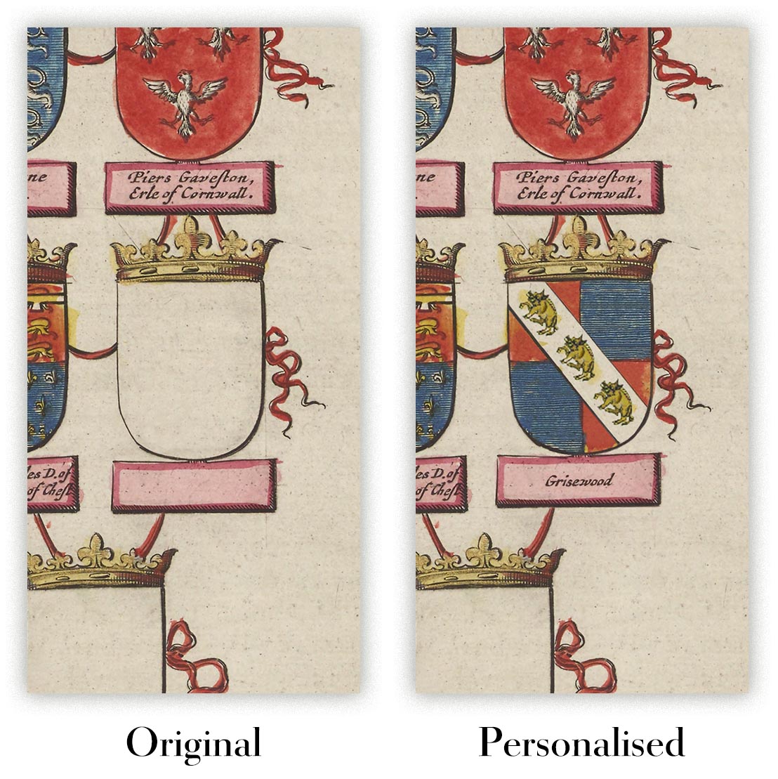
Where personalisation is available, you can add a short title or dedication, mark one meaningful place, or request one considered visual detail. See personalised map examples.
Every piece is printed to museum-grade archival standards using fade-resistant pigment inks on acid-free matte paper. Choose an unframed map print, framed map or canvas using the finish options above. Framed maps use crystal-clear optical acrylic and arrive ready to hang.
With its rich detail and strong sense of place, this map makes a considered gift for a new home, anniversary, retirement or anyone with a personal connection to the area shown. Still deciding? Explore our collection of rare old and vintage maps to discover another place, period or style.
This artwork is also available as a float framed canvas, sometimes known as a shadow gap framed canvas or canvas floater. The work is printed on artist's cotton canvas and then stretched over a handmade box frame. We then "float" the canvas inside a wooden frame, which is available in a range of colours (black, dark brown, oak, antique gold and white). This is a wonderful way to present an art print without glazing in front. See some examples of float framed canvas art and explore the differences between my different finishes.
Principal eminences of the British Islands, issued by James Reynolds in 1852, distills the Victorian passion for measurement and beauty into a single, striking comparative plate. Created at the high tide of the Industrial Revolution, it belongs to Reynolds’s celebrated suite of 33 pictorial plates with accompanying text, designed to make science as vivid as it was exact. Hand-colored engravings arrange Britain and Ireland’s loftiest mountains in orderly ranks, a decorative cartouche crowning a composition that is both elegant and instructive. Here, geography and geology become public knowledge—scaled, labeled, and made legible to the curious reader—mirroring a society newly attentive to altitude, structure, and the practical uses of terrain for engineering, exploration, and national self-understanding.
Reynolds’s design invites comparison at a glance. A vertical scale in feet climbs alongside stylized profiles, while key summits are crisply named and their heights inscribed. The great quartet—Ben Nevis, Carrauntoohil, Snowdon, and Scafell Pike—anchors the scene, their flanks punctuated by smaller, storied hills and fells. Geological figures discreetly annotate the formations beneath, guiding the eye from granite and slate uplands to limestone scarps and volcanic remnants. Along the base, illustrated landmarks and cascading waterfalls provide a human and scenic counterpoint to the austere measure of elevation, turning raw numbers into a narrative of landforms, climate, and culture.
In the Scottish panels, the Highlands assert their primacy, Ben Nevis reigning above the serried ranges of the Grampians and Cairngorms. Waterfalls leap from corries and glens, their placement underscoring the drama of relief and the work of ice and rain over deep time. Edinburgh and Aberdeen appear as coastal and Lowland anchors—urban bookends to the rugged interior—reminding the viewer how closely Britain’s cities are shadowed by their uplands. The visual grammar is Victorian precision: color-washed strata, carefully stepped heights, and a clean, legible script that ties the picturesque to the empirical, honoring both the romance of the north and the rigors of triangulation and survey.
England and Wales share the sheet with equal eloquence. The Pennines—England’s “backbone”—rise near industrial Sheffield, their millstone grit and limestone edges gesturing toward quarries, canals, and railways that conquered passes and moors. Farther west, the Lake District’s fells—Scafell Pike and its companions—lift from a mosaic of valleys and tarns, while Wales counters with Snowdon and the ramparts of the Cambrian ranges and Brecon Beacons. London, the nation’s mercantile heart, reads here as counterpoise: a metropolis measured against mountains. Waterfalls sketched beneath the peaks evoke the kinetic power that Victorian engineers sought to harness, making the plate both a lesson in topography and a parable of industry meeting nature.
Across the Irish Sea, Ireland’s varied uplands complete the story. Carrauntoohil crowns the MacGillycuddy’s Reeks with austere authority, while the Wicklow Mountains rise within sight of Dublin and the Mournes keep close watch over Belfast—urban centers cued as wayfinding points in a landscape of granite, quartzite, and basaltic plateaux. Reynolds’s geological symbols stitch these islands into a single tectonic tale, even as local names preserve regional character. The result is a consummate Victorian artifact: artfully colored, scrupulously indexed, and animated by the era’s faith that to list, rank, and compare was to understand. As a cultural document, it charts not only peaks, but the ascent of public science itself.
Where personalisation is available, you can add a short title or dedication, mark one meaningful place, or request one considered visual detail. See personalised map examples.
Every piece is printed to museum-grade archival standards using fade-resistant pigment inks on acid-free matte paper. Choose an unframed map print, framed map or canvas using the finish options above. Framed maps use crystal-clear optical acrylic and arrive ready to hang.
With its rich detail and strong sense of place, this map makes a considered gift for a new home, anniversary, retirement or anyone with a personal connection to the area shown. Still deciding? Explore our collection of rare old and vintage maps to discover another place, period or style.
This artwork is also available as a float framed canvas, sometimes known as a shadow gap framed canvas or canvas floater. The work is printed on artist's cotton canvas and then stretched over a handmade box frame. We then "float" the canvas inside a wooden frame, which is available in a range of colours (black, dark brown, oak, antique gold and white). This is a wonderful way to present an art print without glazing in front. See some examples of float framed canvas art and explore the differences between my different finishes.
Nombre de nos cartes et tirages d’art sont choisis comme cadeaux attentionnés pour des intérieurs, des bureaux, des cabinets de travail et des lieux chargés de sens.
Choisissez une option encadrée pour un cadeau prêt à être accroché en toute simplicité, ou optez pour un tirage non encadré si le destinataire préfère peut-être sélectionner son propre cadre.
Nous fabriquons les commandes localement dans 23 pays à travers le monde, afin que les cadeaux puissent souvent être produits à proximité du destinataire. Cela permet une livraison plus rapide, un transport plus sûr et d’éviter les surprises liées aux frais de douane ou droits d’importation.
- Nous pouvons livrer directement au destinataire
- Les pièces encadrées arrivent prêtes à être accrochées
- Les tirages non encadrés sont soigneusement emballés dans un tube de protection robuste
- Presque chaque commande est fabriquée localement, pour des cadeaux plus rapides et plus sûrs
- Les retours sous 90 jours laissent au destinataire le temps de se décider
Si vous hésitez sur le choix à faire, veuillez nous contacter. Nous pouvons vous aider à choisir la carte, le format, la finition ou l’option de livraison appropriés.
Pour la plupart des commandes, le délai de livraison est d'environ 3 jours ouvrables. Les produits personnalisés et sur mesure prennent plus de temps, car je dois faire la personnalisation et vous l'envoyer pour approbation, ce qui prend généralement 1 ou 2 jours.
Veuillez noter que les grandes commandes encadrées prennent généralement plus de temps à réaliser et à livrer.
Si vous avez besoin que votre commande arrive à une date précise, veuillez me contacter avant de passer votre commande afin que nous puissions trouver le meilleur moyen de nous assurer que vous receviez votre commande à temps.
J'imprime et encadre des cartes et des œuvres d'art dans 23 pays à travers le monde. Cela signifie que votre commande sera réalisée localement, ce qui réduit le temps de livraison et garantit qu'elle ne sera pas endommagée pendant le transport. Vous ne paierez jamais de droits de douane ou d'importation, et nous mettrons moins de CO2 dans l'air.
Toutes mes cartes et impressions artistiques sont bien emballées et envoyées dans un tube robuste si non encadrées, ou entourées de mousse si encadrées.
J'essaie d'envoyer toutes les commandes dans les 1 ou 2 jours suivant la réception de votre commande, bien que certains produits (comme les masques, les mugs et les sacs fourre-tout) puissent prendre plus de temps à réaliser.
Si vous choisissez Livraison Express lors du paiement, nous donnerons la priorité à votre commande et l'enverrons par un service de messagerie de 1 jour (Fedex, DHL, UPS, Parcelforce).
La livraison le lendemain est également disponible dans certains pays (États-Unis, Royaume-Uni, Singapour, Émirats Arabes Unis), mais veuillez essayer de commander tôt dans la journée afin que nous puissions l'envoyer à temps.
Lisez mon guide complet sur la livraison et la production locale
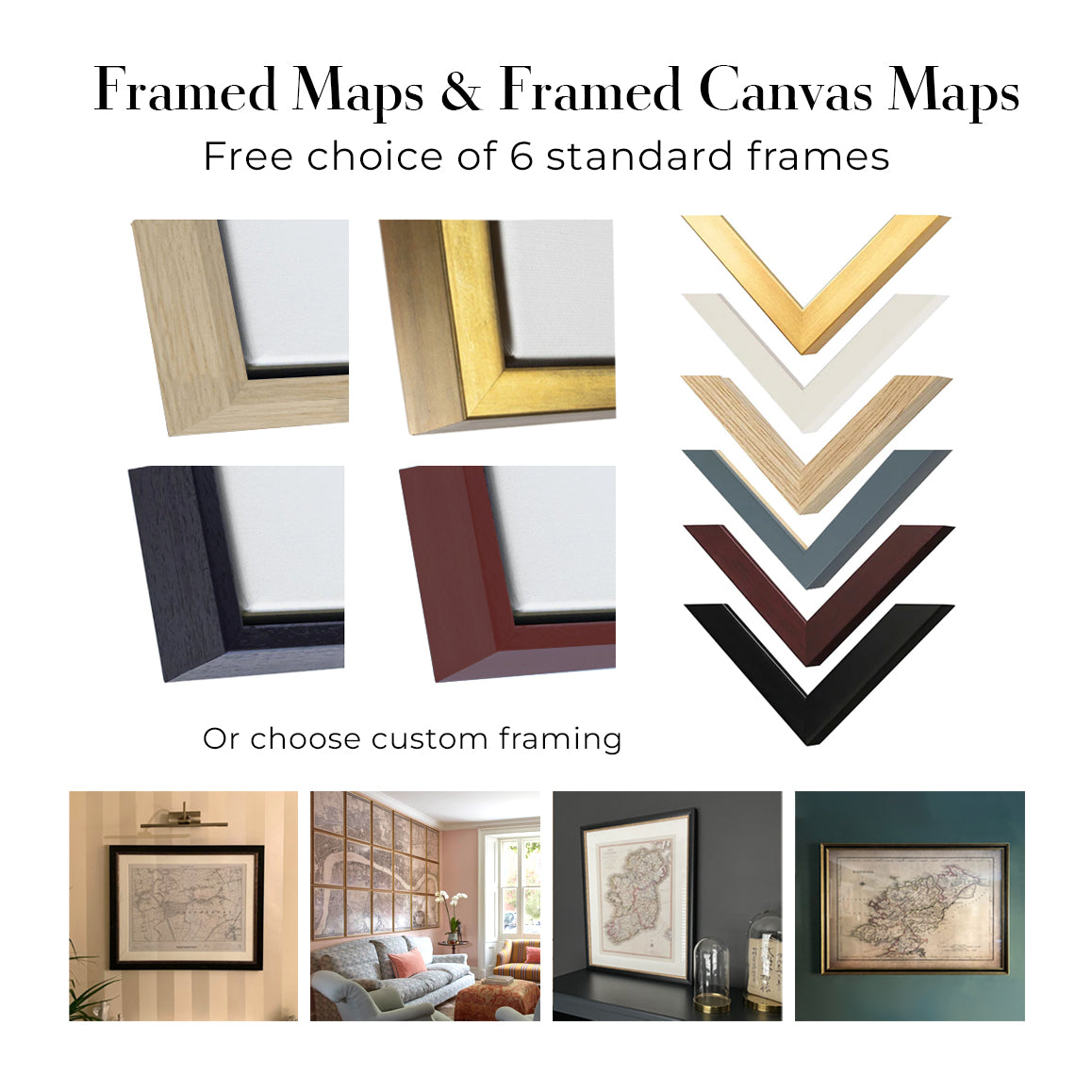
Mon cadre standard est un cadre en bois dur noir de style galerie. Il est simple et a un aspect assez moderne. Mon cadre standard mesure environ 20 mm (0,8 po) de large.
J'utilise de l'acrylique super clair (perspex/acrylite) pour le verre du cadre. C'est plus léger et plus sûr que le verre - et cela a meilleur aspect, car la réflexivité est plus faible.
Six couleurs de cadre standard sont disponibles gratuitement (noir, marron foncé, gris foncé, chêne, blanc et or antique). Des encadrements et montages/matelassages personnalisés sont disponibles si vous recherchez autre chose.
La plupart des cartes, œuvres d'art et illustrations sont également disponibles sous forme de toile encadrée. Nous utilisons une toile en coton mate (non brillante), que nous tendons sur un cadre en bois de boîte provenant de sources durables, puis nous 'flottions' la pièce à l'intérieur d'un cadre en bois. Le résultat final est assez beau, et il n'y a pas de vitrage qui gêne.
Tous les cadres sont fournis "prêts à accrocher", avec soit une corde, soit des supports à l'arrière. Les très grands cadres auront des plaques de suspension lourdes et/ou une latte de montage. Si vous avez des questions, veuillez nous contacter.
Voir quelques exemples de mes cartes encadrées et de cartes en toile encadrées.
Alternativement, je peux également fournir de vieilles cartes et œuvres d'art sur toile, sur panneau en mousse, en coton et d'autres matériaux.
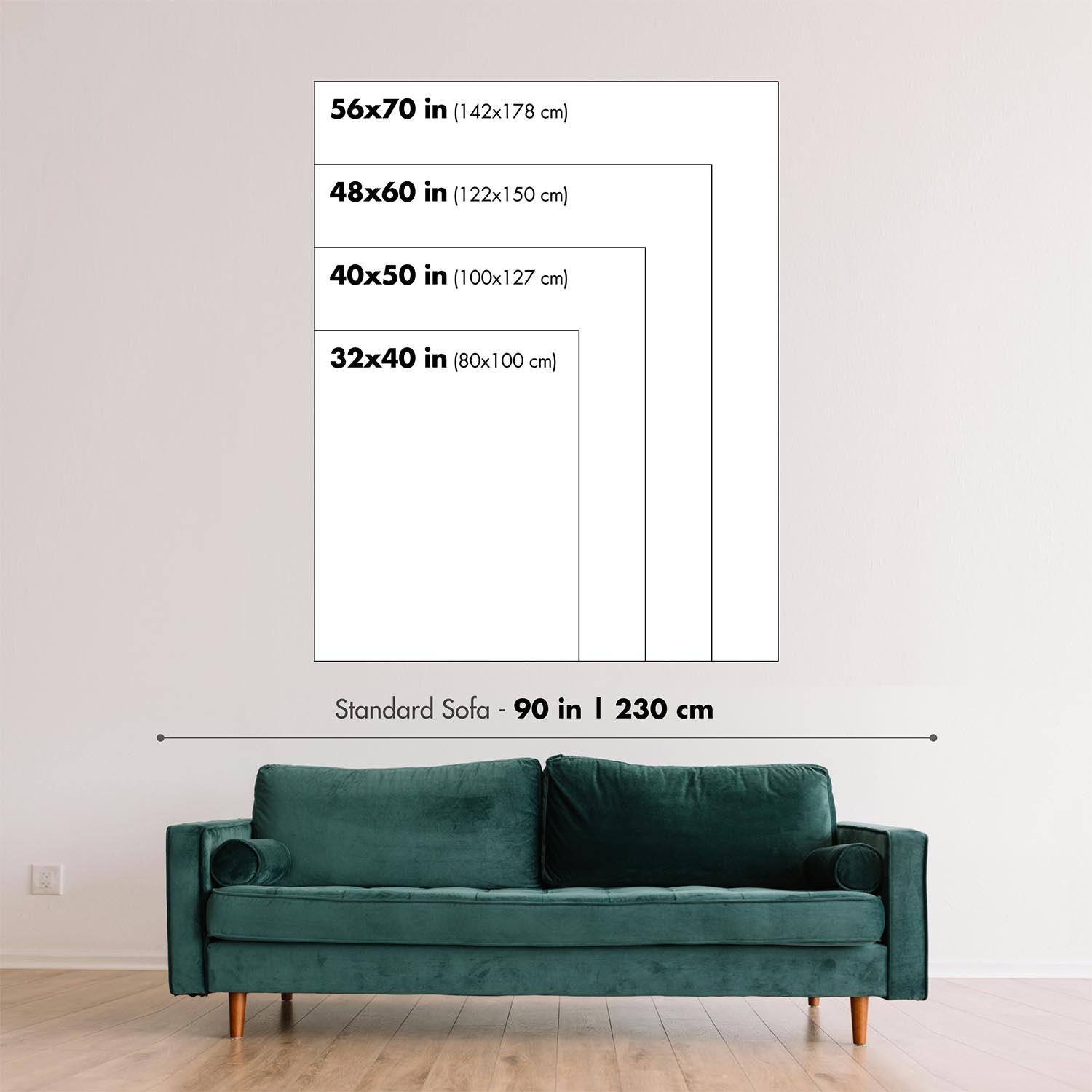
Si vous souhaitez encadrer votre carte ou œuvre d'art vous-même, veuillez lire d'abord mon guide des tailles.
Nous travaillons avec des architectes d’intérieur, des établissements hôteliers, des professionnels de l’immobilier, des bureaux et des acheteurs d’entreprise, pour des pièces individuelles comme pour des projets coordonnés de plus grande envergure.
Cette œuvre peut être adaptée à un mur, une pièce ou un projet spécifique, et notre atelier peut vous aider à coordonner les dimensions, le matériau et l’encadrement avant la production.
- Dimensions exactes, grand format et sur mesure
- Encadrement, montage et matériaux alternatifs sur mesure
- Pièces coordonnées pour plusieurs pièces ou emplacements
- Personnalisation de l’œuvre, pour ajuster la couleur et le style de la pièce
- Conseils de notre atelier sur l’œuvre et l’encadrement
- Production locale pour des projets dans le monde entier
Échangez avec notre équipe Trade & Projects au sujet de cette pièce
Chaque impression artistique restaurée commence par l’œuvre originale de l’artiste — jamais par un substitut généré par IA.
Notre atelier de Londres travaille à partir de documents source soigneusement sélectionnés dans des musées, bibliothèques, archives et collections privées. Nous restaurons les dommages liés à l’âge, les couleurs passées et les défauts de reproduction, tout en préservant la composition, les coups de pinceau, le trait, la texture et le caractère d’époque de l’artiste.
Nous n’utilisons pas d’IA générative pour redessiner, réinterpréter ou inventer l’œuvre. La restauration numérique est utilisée uniquement pour récupérer et reproduire l’œuvre originale aussi fidèlement que possible.
Une fois restaurée, l’œuvre maîtresse est préparée dans le format et la finition que vous avez choisis. Votre pièce est ensuite imprimée et, le cas échéant, encadrée à proximité de sa destination de livraison.
Nos impressions d’art giclée utilisent un papier mat d’archivage sans acide de 200 g/m² et des encres pigmentaires résistantes à la décoloration pour une finition riche, digne d’un musée. Les impressions d’art encadrées utilisent un acrylique optique cristallin et arrivent prêtes à être accrochées.
Des toiles encadrées et des éditions spécialisées sur papier coton-rag sont également disponibles. En savoir plus sur nos matériaux et finitions.
Nous restaurons et produisons des cartes et des tirages d’art depuis 1984, et nous garantissons chaque pièce.
Chaque commande est couverte par notre garantie de 10 ans et notre garantie de livraison sans dommage. Si votre pièce arrive endommagée, nous la remplacerons ou la referons gratuitement. Si quoi que ce soit d’autre ne vous donne pas entière satisfaction, contactez notre équipe d’atelier et nous y remédierons rapidement.
Consultez notre politique de retours et de remboursement pour plus de détails.


