


Grande Mappa Antica di Londra: 1746, 1788, 1830 o 1862. Grande mappa personalizzata fino a 4 metri (13 piedi)
20% di sconto su 2 — 33% di sconto su 3
Aggiungi qualsiasi due articoli idonei al tuo carrello per ricevere 20% di sconto. Aggiungi un terzo e sarà gratuito (equivalente a 33% di sconto quando acquisti tre).
Nessun codice necessario — l'offerta si applica automaticamente al checkout.
Valido su tutte le mappe standard e le stampe d'arte fine. Puoi mescolare e abbinare qualsiasi design.
Se desideri spedire articoli a più indirizzi, ti preghiamo di contattarci prima di effettuare il tuo ordine.
Le commissioni personalizzate e su misura sono escluse.
Contattaci se hai domande
-
![]() Made to order locally in Canada
Made to order locally in Canada

-
Free delivery 2-3 days ⓘ
Free delivery in 2-3 days
Your map should be delivered in 2-3 working days with free delivery, worldwide.
We make maps by hand locally in 23 countries, including Canada
![]() . If you're buying a gift for someone in another country, we will make the map locally to them.
. If you're buying a gift for someone in another country, we will make the map locally to them.You will never pay import tax or customs duty.
Express delivery is available at checkout which can reduce the delivery time to 1-2 days.
Please note that personalised maps, and larger framed maps, can take longer to produce and deliver.
If you need your order to arrive by a certain date, contact me and we can discuss your options.
-
Complimentary gifting & design advice
ⓘ
Complimentary gifting & design advice
Available almost 24/7 on WhatsApp and email — we usually reply within minutes. We can help you:
- Choose a perfectly personalised gift
- Send a digital gift preview to the recipient
- Pick the ideal size for your wall
- Select the right finish and frame
Quick, friendly advice so you can order with confidence.
For last minute gifts, consider buying a digital gift card. We have over 5,000 maps and art prints to choose from.
-
90-day returns & 5-year guarantee
ⓘ
90 giorni per restituire e ricevere un rimborso
I prodotti possono essere restituiti entro 90 giorni per un rimborso completo, o cambio con un altro prodotto.
Per articoli personalizzati e su misura, potremmo offrirti un credito in negozio o una carta regalo non scadente, poiché non possiamo rivendere ordini personalizzati.
Se hai domande, contattaci. Per ulteriori informazioni, consulta la nostra politica di restituzione e cambio.

This is a museum-grade archival print from the original 1746 map — restored in our workshop and made to order on 220gsm archival matte paper or 400gsm artist's cotton canvas with pigment inks.
Professional framing & free personalisation available.
1. Choose a size
2. Frame & personalise your map
Make your map unique with framing, hand-drawn customisation, vintage ageing, pop art text, unique 3D styling and more.


Gift message & custom finish

If you want to add a gift message, or a finish (jigsaw, aluminium board, etc.) that is not available here, please request it in the "order note" when you check out.
Every order is custom made, so if you need the size adjusted slightly, or printed on an unusual material, just let us know. We've done thousands of custom orders over the years, so there's (almost) nothing we can't manage.
You can also contact us before you order, if you prefer!

- Handmade locally. No import duty or tax
- FREE worldwide delivery
- 90-day returns & 5-year product guarantee
- Questions? WhatsApp me any time
Own a piece of history
7,000+ 5 star reviews


Ho sei mappe antiche e straordinarie di Londra che possono essere stampate in dimensioni fino a 10 metri di larghezza (33 piedi). Possono essere personalizzate per adattarsi al tuo spazio o per concentrarsi su una particolare parte di Londra - posso rendere le mappe più larghe, più strette, più alte o più corte.
Se desideri vedere le mappe in maggiore dettaglio, scorri verso il basso e trova i link alle singole pagine dei prodotti. Puoi vedere mappe ad altissima risoluzione che puoi ingrandire e spostare.
Ogni mappa è stata amorevolmente restaurata dall'originale mappa antica. Ogni mappa sarà realizzata a mano e stampata ad altissima risoluzione secondo le tue esatte esigenze. Se non sei soddisfatto della tua mappa, cosa che penso sia molto improbabile, puoi restituirla per un rimborso completo senza problemi.
Queste grandi mappe sarebbero perfette per hotel, uffici, pub, bar o altri spazi di ospitalità - ma se hai uno spazio ampio a casa, allora apparirebbero magnifiche anche lì!
Per favore contattami prima di ordinare in modo da poter discutere di ciò che stai cercando e assicurarci che la mappa che acquisti apparirà perfetta.
Posso anche incorniciare la tua mappa e consegnarla tramite un servizio di corriere speciale. Basta contattarmi e ti invierò un preventivo, solitamente entro poche ore.
Ci sono sei vecchie mappe capolavoro di Londra tra cui scegliere:
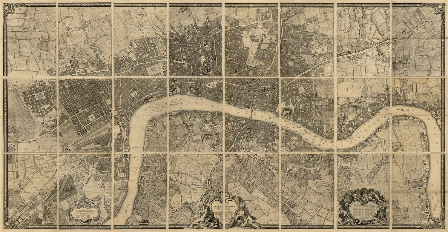
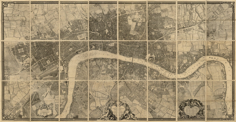
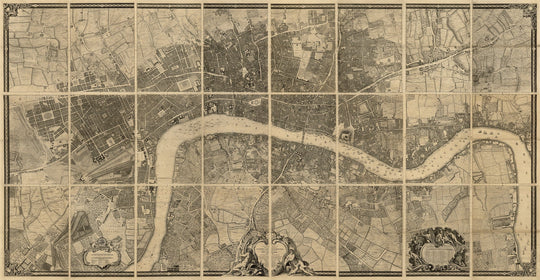
- La mappa di Londra, Westminster e Southwark di John Rocque, 1746. Questa è l'originale (e probabilmente la migliore) mappa della vecchia Londra. È stata originariamente stampata in 24 fogli ed era larga 4 metri. Posso ricreare l'intera mappa per te - oppure, se hai solo uno spazio quadrato, potremmo creare una versione personalizzata che si adatti perfettamente.
Ho due versioni di questa mappa - una mappa invecchiata, seppia, e una versione in scala di grigi monocromatica. Entrambe sono bellissime. Visita l'elenco per saperne di più.
- Le mappe della povertà di Londra di Charles Booth, 1898-99. Originariamente stampata in 12 fogli, questa è una delle mappe più insolite e affascinanti di Londra o di qualsiasi città al mondo. Non solo è una mappa incredibilmente dettagliata di una vasta parte del centro e della periferia di Londra, ma Booth ha esaminato la ricchezza di ogni casa e strada di Londra. Puoi vedere quali parti di Londra erano di classe alta, classe media o addirittura 'semi criminali' nella Londra vittoriana. Scopri di più su questa mappa e guarda immagini dettagliate in primo piano.
- La mappa di Londra di C&J Greenwood, 1830. Questa è la migliore mappa antica a colori di Londra. Originariamente stampata in 6 fogli, questa è probabilmente la più bella delle tre mappe. I parchi sono verdi, il Tamigi è blu. Anche alcuni altri punti di riferimento famosi erano stati costruiti nel 1830.
Ho 3 varianti diverse di questa mappa - completamente colorata a mano , monocromatico e monocromatico con un Tamigi blu che sembra davvero straordinario.
- La mappa di Londra di John Rocque e 10 miglia attorno, 1745. Questa è l'altra mappa principale che John Rocque produsse di Londra. C'è meno dettaglio, ma la mappa si estende fino alla maggior parte dei sobborghi di Londra, inclusi Hackney, Wimbledon, Highgate e Richmond. È una mappa bellissima che mostra Londra quando gran parte dell'area era ancora campi e foreste. Scopri di più su questa mappa e guarda alcune immagini ravvicinate.
- La mappa della biblioteca di Edward Stanford di Londra e dei suoi sobborghi, 1862. Questa è la mappa più dettagliata di Londra e dei suoi sobborghi del 1800. Pubblicata originariamente in 24 fogli, c'è un'incredibile quantità di dettagli in questa mappa - quasi ogni singolo edificio di Londra è rappresentato. Questa mappa mostra Londra al culmine dell'Impero Britannico - ma quando la maggior parte dei suoi sobborghi erano ancora solo campi. Questa mappa è perfetta per mappe ingrandite e personalizzate di Londra se stai cercando una mappa personalizzata che si concentri su un'area specifica. Posso anche stampare questa mappa in dimensioni enormi - fino a 10 metri (33 piedi) di larghezza. Ti consiglio di guardare l'elenco specifico per questa mappa in modo da poter comprendere il livello di dettaglio in questa mappa.
- La mappa di Londra di William Faden e 25 miglia attorno, 1790. Questa mappa, in netto contrasto con la mappa dei sobborghi di Rocque, ha molti più colori e carattere. Ingrandendo, vedrai molto di più - è il tipo di mappa su cui potresti passare ore a studiare, cercando vecchi nomi di città, foreste in cui correvi da bambino, ecc. Questa mappa appare fantastica in dimensioni fino a 3m (10ft). Vedi l'elenco separato per questa mappa se vuoi vedere più foto ravvicinate della mappa.
Posso anche incorniciare la tua mappa - contattami e discuteremo del tuo ordine.
Se stai cercando mappe più piccole di Londra, dai un'occhiata a questi elenchi:
- Mappa personalizzata di Londra di Edward Stanford, 1862 (crea la tua mappa!)
- Mappa personalizzata di John Rocque del 1746 di Londra
- Mappa personalizzata della povertà di Londra di Charles Booth del 1798
- Mappa colorata personalizzata di Londra di C&J Greenwood del 1830
This map is also available as a float framed canvas, sometimes known as a shadow gap framed canvas or canvas floater. The map is printed on artist's cotton canvas and then stretched over a handmade box frame. We then "float" the canvas inside a wooden frame, which is available in a range of colours (black, dark brown, oak, antique gold and white). This is a wonderful way to present a map without glazing in front. See some examples of float framed canvas maps and explore the differences between my different finishes.
For most orders, delivery time is about 3 working days. Personalised and customised products take longer, as I have to do the personalisation and send it to you for approval, which usually takes 1 or 2 days.
Please note that very large framed orders usually take longer to make and deliver.
If you need your order to arrive by a certain date, please contact me before you order so that we can find the best way of making sure you get your order in time.
I print and frame maps and artwork in 23 countries around the world. This means your order will be made locally, which cuts down on delivery time and ensures that it won't be damaged during delivery. You'll never pay customs or import duty, and we'll put less CO2 into the air.
All of my maps and art prints are well packaged and sent in a rugged tube if unframed, or surrounded by foam if framed.
I try to send out all orders within 1 or 2 days of receiving your order, though some products (like face masks, mugs and tote bags) can take longer to make.
If you select Express Delivery at checkout your order we will prioritise your order and send it out by 1-day courier (Fedex, DHL, UPS, Parcelforce).
Next Day delivery is also available in some countries (US, UK, Singapore, UAE) but please try to order early in the day so that we can get it sent out on time.
My standard frame is a gallery style black ash hardwood frame. It is simple and quite modern looking. My standard frame is around 20mm (0.8in) wide.
I use super-clear acrylic (perspex/acrylite) for the frame glass. It's lighter and safer than glass - and it looks better, as the reflectivity is lower.
Six standard frame colours are available for free (black, dark brown, dark grey, oak, white and antique gold). Custom framing and mounting/matting is available if you're looking for something else.
Most maps, art and illustrations are also available as a framed canvas. We use matte (not shiny) cotton canvas, stretch it over a sustainably sourced box wood frame, and then 'float' the piece within a wood frame. The end result is quite beautiful, and there's no glazing to get in the way.
All frames are provided "ready to hang", with either a string or brackets on the back. Very large frames will have heavy duty hanging plates and/or a mounting baton. If you have any questions, please get in touch.
See some examples of my framed maps and framed canvas maps.
Alternatively, I can also supply old maps and artwork on canvas, foam board, cotton rag and other materials.
If you want to frame your map or artwork yourself, please read my size guide first.
Alcune delle mie vecchie mappe sono ora disponibili come tele incorniciate. Per favore contattami se desideri ordinare una dimensione che non è disponibile nel mio negozio.
Le vecchie mappe su tela sono un'alternativa interessante alle mappe incorniciate in modo convenzionale. A seconda del tuo gusto personale e dell'arredamento della stanza, le mappe su tela possono "risaltare" un po' di più rispetto a una mappa incorniciata.
My maps are extremely high quality reproductions of original maps.
I source original, rare maps from libraries, auction houses and private collections around the world, restore them at my London workshop, and then use specialist giclée inks and printers to create beautiful maps that look even better than the original.
My maps are printed on acid-free archival matte (not glossy) paper that feels very high quality and almost like card. In technical terms the paper weight/thickness is 10mil/200gsm. It's perfect for framing.
I print with Epson ultrachrome giclée UV fade resistant pigment inks - some of the best inks you can find.
I can also make maps on canvas, cotton rag and other exotic materials.
Learn more about The Unique Maps Co.
Map personalisation
If you're looking for the perfect anniversary or housewarming gift, I can personalise your map to make it truly unique. For example, I can add a short message, or highlight an important location, or add your family's coat of arms.
The options are almost infinite. Please see my map personalisation page for some wonderful examples of what's possible.
To order a personalised map, select "personalise your map" before adding it to your basket.
Get in touch if you're looking for more complex customisations and personalisations.
Map ageing
I have been asked hundreds of times over the years by customers if they could buy a map that looks even older.
Well, now you can, by selecting Aged before you add a map to your basket.
All the product photos you see on this page show the map in its Original form. This is what the map looks like today.
If you select Aged, I will age your map by hand, using a special and unique process developed through years of studying old maps, talking to researchers to understand the chemistry of aging paper, and of course... lots of practice!
If you're unsure, stick to the Original colour of the map. If you want something a bit darker and older looking, go for Aged.
Se non sei soddisfatto del tuo ordine per qualsiasi motivo, contattami per un rimborso senza problemi. Si prega di consultare la nostra politica di reso e rimborso per ulteriori informazioni.
Sono molto sicuro che ti piacerà la tua mappa restaurata o la stampa d'arte. Lo faccio dal 1984. Sono un venditore Etsy a 5 stelle. Ho venduto decine di migliaia di mappe e stampe d'arte e ho oltre 5.000 recensioni reali a 5 stelle.
Utilizzo un processo unico per restaurare mappe e opere d'arte che richiede molto tempo e lavoro. Trovare le mappe e le illustrazioni originali può richiedere mesi. Utilizzo tecnologia all'avanguardia e incredibilmente costosa per scannerizzare e restaurarle. Di conseguenza, garantisco che le mie mappe e stampe d'arte siano superiori alle altre - ecco perché posso offrire un rimborso senza problemi.
Quasi tutte le mie mappe e stampe d'arte sembrano fantastiche a grandi dimensioni (200 cm, 6,5 piedi+) e posso anche incorniciarle e consegnarle a te, tramite un corriere speciale per oggetti di grandi dimensioni. Contattami per discutere delle tue esigenze specifiche.
Or try searching for something!


