


Antica mappa dell'Irlanda di Lewis, 1846: Dublino, Cork, fiume Shannon, contee e province, prime ferrovie
L’offerta del Collezionista
Scegli due opere idonee e ricevi il 20% di sconto su entrambe. Scegline tre e quella al prezzo più basso è in omaggio, con un risparmio massimo del 33%.
Abbina liberamente mappe standard idonee e stampe d’arte fine art. Non è richiesto alcun codice; l’offerta viene applicata automaticamente al checkout.
Sono incluse le configurazioni standard su ordinazione. Sono esclusi formati su misura, design personalizzati e lavori su commissione.
Hai bisogno di consegne a indirizzi diversi? Contattaci prima di effettuare l’ordine.L’offerta del Collezionista
Scegli due opere idonee e ricevi il 20% di sconto su entrambe. Scegline tre e quella al prezzo più basso è in omaggio, con un risparmio massimo del 33%.
Abbina liberamente mappe standard idonee e stampe d’arte fine art. Non è richiesto alcun codice; l’offerta viene applicata automaticamente al checkout.
Sono incluse le configurazioni standard su ordinazione. Sono esclusi formati su misura, design personalizzati e lavori su commissione.
Hai bisogno di consegne a indirizzi diversi? Contattaci prima di effettuare l’ordine. Progettato a Londra Prodotto in Canada
Progettato a Londra • Prodotto in Canada
Progettato a Londra Prodotto in Canada
Progettato a Londra • Prodotto in Canada

Restaurata dalla mappa originale del 1846 e stampata in qualità museale. Leggi la storia dietro questa mappa
Choose your size
Choose your finish


(Maggiori informazioni)
Gift message & custom finish

If you want to add a gift message, or a finish (jigsaw, aluminium board, etc.) that is not available here, please request it in the "order note" when you check out.
Every order is custom made, so if you need the size adjusted slightly, or printed on an unusual material, just let us know. We've done thousands of custom orders over the years, so there's (almost) nothing we can't manage.
You can also contact us before you order, if you prefer!

- Prodotto localmente. Consegna sicura
- Nessun dazio o costo nascosto
- Serve aiuto? Chiamaci o messaggio su WhatsApp
Own a piece of history
8,000+ five-star reviews


La mappa dell’Irlanda, suddivisa in province e contee, pubblicata nel 1846 come parte dell’Atlas of Ireland di Lewis, è un capolavoro di...
Continua a leggereLa mappa dell’Irlanda, suddivisa in province e contee, pubblicata nel 1846 come parte dell’Atlas of Ireland di Lewis, è un capolavoro di design limpido e ambizione empirica. La visione di Samuel Lewis si realizza attraverso il preciso disegno di R. Creighton e l’incisione pulita e sicura di I. Dower, che restituiscono l’isola con disciplinata chiarezza. Una delicata coloritura dei contorni distingue Ulster, Leinster, Munster e Connacht, mentre gli orli conferiscono una dimensione scultorea agli altipiani e alle catene montuose. Una legenda accuratamente composta decifra i simboli delle principali strade, dei percorsi postali, delle ferrovie emergenti, dei fiumi, dei laghi e dei canali, guidando lo sguardo dalla costa all’interno. Il risultato è al tempo stesso elegante e rigoroso: un ritratto nazionale che bilancia l’ordine amministrativo con la geografia viva di città, acque e rilievi.
Samuel Lewis, noto per i suoi dizionari topografici e atlanti di Gran Bretagna e Irlanda, coltivò uno stile editoriale che univa informazioni affidabili ed estetica raffinata. In questa mappa, la sua impostazione editoriale è inconfondibile: le linee di confine sono nette, le contee sono chiaramente articolate e la gerarchia degli insediamenti—dalle città alle stazioni postali e ai villaggi—si legge a colpo d’occhio. Il tratto di Creighton garantisce armonia proporzionale e leggibilità, mentre il bulino di Dower coglie la complessità delle coste e le anse dei fiumi senza sacrificare la chiarezza. Pubblicata da S. Lewis & Co. a Londra, la tavola riflette una fiducia metropolitana nel sapere di pubblica utilità, offrendo un quadro autorevole per il viaggio, l’amministrazione e lo studio dell’intera isola.
Qui la geografia è resa come un paesaggio narrativo. Gli orli modellano il peso dei monti Wicklow e le forme aspre del sud-ovest, mentre lievi gradazioni indicano le distese più dolci delle Midlands. L’idrografia della carta è una presenza ordinatrice: lo Shannon si dispiega come una spina dorsale attraverso Connacht e Munster; il Lough Neagh si amplia nel nord; il Lough Corrib e altre acque occidentali si adagiano contro coste rocciose. Estuari e baie articolano la linea di costa, dagli insenature di Cork e Kerry alle bassure presso Dublino e Louth, e i mari circostanti—attraverso il North Channel e lo St George’s Channel—collocano l’Irlanda nel suo mondo marittimo. Ogni elemento è composto per mostrare come la morfologia e le vie d’acqua governino il movimento e l’insediamento.
Città e centri abitati appaiono come una trama di commercio, cultura e comunicazione. Dublino ancor a l’est, il cui ruolo è sottolineato dal convergere dei percorsi postali e delle principali strade che la collegano a Cork e Limerick a sud e a ovest, a Galway attraverso le Midlands e ai porti di Waterford e Wexford lungo il sud-est. La notazione dei centri postali e dei villaggi, insieme a nodi strategici come Drogheda, Sligo, Kilkenny e Tralee, rivela una gerarchia di servizi e scambi. Le prime ferrovie, chiaramente segnate, iniziano a irradiarsi dai poli principali, segnalando un nuovo ritmo del viaggio—binari di ferro che intrecciano le vie tradizionali e i canali, prefigurando le reti trasformative che avrebbero presto ridisegnato la mobilità irlandese.
Creato in un momento di profonda transizione, questo dipinto del 1846 preserva il panorama amministrativo dell’Irlanda pre-Partition alle soglie della modernità. L’attenzione alle infrastrutture—strade postali, linee ferroviarie nascenti, canali navigabili—cattura i sistemi pratici attraverso cui persone, merci e idee si muovevano, mentre le pressioni sociali ed economiche dell’epoca andavano intensificandosi. Parte dell’Atlas of Ireland di Lewis, la mappa è al tempo stesso strumento e archivio: un documento di contee e province che ancora risuonano, e di percorsi storici che rivelano come l’isola fosse organizzata, governata e attraversata. Unisce arte e utilità, offrendo una testimonianza lucida e dignitosa della forma, dei luoghi e del ritmo dell’Irlanda.
Città e centri abitati presenti in questa mappa
- Dublino
- Cork
- Limerick
- Galway
- Waterford
- Drogheda
- Sligo
- Kilkenny
- Wexford
- Tralee
Caratteristiche e punti di riferimento notevoli
- Confini amministrativi: divisioni chiaramente segnate tra province e contee.
- Percorsi di viaggio: linee che indicano le principali strade e le rotte postali.
- Ferrovie: rappresentazioni delle linee ferroviarie in sviluppo a metà del XIX secolo.
- Elementi idrografici: fiumi, laghi e canali sono illustrati, migliorando la comprensione della navigazione.
- Campiture a tratteggio: utilizzate per rappresentare l’altimetria e il rilievo del terreno.
- Riquadri/legenda: è fornita una spiegazione dei simboli usati sulla mappa, a testimonianza delle convenzioni cartografiche dell’epoca.
Contesto storico e di design
- Titolo della mappa: Map of Ireland, divided into provinces & counties
- Anno di creazione: 1846
- Cartografo/Editore: realizzata da Samuel Lewis, disegnata da R. Creighton e incisa da I. Dower. Pubblicata da S. Lewis and Co., Londra.
- Design e stile della mappa: si tratta di una mappa colorata a mano, piegata a contorno, che mette in mostra una raffinata minuzia e una maestria tipiche della cartografia di metà Ottocento. Il rilievo è rappresentato con campiture a tratteggio, conferendo al terreno una qualità tridimensionale.
- Rilevanza storica: la mappa fa parte di 'Lewis's Atlas of Ireland' e costituisce un prezioso documento storico che riflette le infrastrutture di viaggio e le divisioni amministrative dell’Irlanda a metà del XIX secolo.
- Regioni e contee raffigurate: la mappa comprende l’intera Irlanda, suddivisa in varie province e contee, tra cui Ulster, Leinster, Munster e Connacht.
- Contesto sul cartografo: Samuel Lewis era noto per i suoi contributi alla cartografia e alla storia locale in Gran Bretagna. Fondò una casa editrice che produsse atlanti dettagliati e dizionari topografici, lasciando un’eredità significativa nel settore.
Controllate attentamente le immagini per assicurarvi che una città o un luogo specifico sia presente su questa mappa. Potete anche contattarci e chiederci di verificarla per voi.
Questa mappa è splendida in ogni formato, ma consiglio sempre di scegliere una dimensione maggiore se avete spazio a disposizione. In questo modo potrete distinguere facilmente tutti i dettagli.
Questa mappa è straordinaria fino a formati di 70in (180cm). Se cercate una mappa più grande, vi preghiamo di contattarci.
Il modello nelle immagini dell’inserzione tiene in mano la versione 16x20in (40x50cm) di questa mappa.
La quinta immagine dell’inserzione mostra un esempio del mio servizio di personalizzazione delle mappe.
Se cercate qualcosa di leggermente diverso, date un’occhiata alla mia collezione delle migliori mappe antiche per vedere se qualcos’altro attira la tua attenzione.
Ti prego di contattarmi per verificare se una determinata località, punto di riferimento o elemento è presente su questa mappa.
Questa sarebbe una splendida idea regalo per un compleanno, Natale, la festa del papà, un addio al lavoro, un anniversario o un’inaugurazione di casa per qualcuno proveniente dalle aree coperte da questa mappa.
Questa mappa è disponibile come stampa giclée su carta opaca archivistica priva di acidi, oppure puoi acquistarla già incorniciata. La cornice è una bella e semplice cornice nera che si adatta alla maggior parte degli stili. Ti prego di contattarmi se desideri un colore o un materiale diverso per la cornice. Le mie cornici sono protette da acrilico di qualità museale super trasparente (perspex/acrylite), molto meno riflettente del vetro, più sicuro e che arriverà sempre in perfette condizioni.
This map is also available as a float framed canvas, sometimes known as a shadow gap framed canvas or canvas floater. The map is printed on artist's cotton canvas and then stretched over a handmade box frame. We then "float" the canvas inside a wooden frame, which is available in a range of colours (black, dark brown, oak, antique gold and white). This is a wonderful way to present a map without glazing in front. See some examples of float framed canvas maps and explore the differences between my different finishes.
For something truly unique, this map is also available in "Unique 3D", our trademarked process that dramatically transforms the map so that it has a wonderful sense of depth. We combine the original map with detailed topography and elevation data, so that mountains and the terrain really "pop". For more info and examples of 3D maps, check my Unique 3D page.
La mappa dell’Irlanda, suddivisa in province e contee, pubblicata nel 1846 come parte dell’Atlas of Ireland di Lewis, è un capolavoro di design limpido e ambizione empirica. La visione di Samuel Lewis si realizza attraverso il preciso disegno di R. Creighton e l’incisione pulita e sicura di I. Dower, che restituiscono l’isola con disciplinata chiarezza. Una delicata coloritura dei contorni distingue Ulster, Leinster, Munster e Connacht, mentre gli orli conferiscono una dimensione scultorea agli altipiani e alle catene montuose. Una legenda accuratamente composta decifra i simboli delle principali strade, dei percorsi postali, delle ferrovie emergenti, dei fiumi, dei laghi e dei canali, guidando lo sguardo dalla costa all’interno. Il risultato è al tempo stesso elegante e rigoroso: un ritratto nazionale che bilancia l’ordine amministrativo con la geografia viva di città, acque e rilievi.
Samuel Lewis, noto per i suoi dizionari topografici e atlanti di Gran Bretagna e Irlanda, coltivò uno stile editoriale che univa informazioni affidabili ed estetica raffinata. In questa mappa, la sua impostazione editoriale è inconfondibile: le linee di confine sono nette, le contee sono chiaramente articolate e la gerarchia degli insediamenti—dalle città alle stazioni postali e ai villaggi—si legge a colpo d’occhio. Il tratto di Creighton garantisce armonia proporzionale e leggibilità, mentre il bulino di Dower coglie la complessità delle coste e le anse dei fiumi senza sacrificare la chiarezza. Pubblicata da S. Lewis & Co. a Londra, la tavola riflette una fiducia metropolitana nel sapere di pubblica utilità, offrendo un quadro autorevole per il viaggio, l’amministrazione e lo studio dell’intera isola.
Qui la geografia è resa come un paesaggio narrativo. Gli orli modellano il peso dei monti Wicklow e le forme aspre del sud-ovest, mentre lievi gradazioni indicano le distese più dolci delle Midlands. L’idrografia della carta è una presenza ordinatrice: lo Shannon si dispiega come una spina dorsale attraverso Connacht e Munster; il Lough Neagh si amplia nel nord; il Lough Corrib e altre acque occidentali si adagiano contro coste rocciose. Estuari e baie articolano la linea di costa, dagli insenature di Cork e Kerry alle bassure presso Dublino e Louth, e i mari circostanti—attraverso il North Channel e lo St George’s Channel—collocano l’Irlanda nel suo mondo marittimo. Ogni elemento è composto per mostrare come la morfologia e le vie d’acqua governino il movimento e l’insediamento.
Città e centri abitati appaiono come una trama di commercio, cultura e comunicazione. Dublino ancor a l’est, il cui ruolo è sottolineato dal convergere dei percorsi postali e delle principali strade che la collegano a Cork e Limerick a sud e a ovest, a Galway attraverso le Midlands e ai porti di Waterford e Wexford lungo il sud-est. La notazione dei centri postali e dei villaggi, insieme a nodi strategici come Drogheda, Sligo, Kilkenny e Tralee, rivela una gerarchia di servizi e scambi. Le prime ferrovie, chiaramente segnate, iniziano a irradiarsi dai poli principali, segnalando un nuovo ritmo del viaggio—binari di ferro che intrecciano le vie tradizionali e i canali, prefigurando le reti trasformative che avrebbero presto ridisegnato la mobilità irlandese.
Creato in un momento di profonda transizione, questo dipinto del 1846 preserva il panorama amministrativo dell’Irlanda pre-Partition alle soglie della modernità. L’attenzione alle infrastrutture—strade postali, linee ferroviarie nascenti, canali navigabili—cattura i sistemi pratici attraverso cui persone, merci e idee si muovevano, mentre le pressioni sociali ed economiche dell’epoca andavano intensificandosi. Parte dell’Atlas of Ireland di Lewis, la mappa è al tempo stesso strumento e archivio: un documento di contee e province che ancora risuonano, e di percorsi storici che rivelano come l’isola fosse organizzata, governata e attraversata. Unisce arte e utilità, offrendo una testimonianza lucida e dignitosa della forma, dei luoghi e del ritmo dell’Irlanda.
Città e centri abitati presenti in questa mappa
- Dublino
- Cork
- Limerick
- Galway
- Waterford
- Drogheda
- Sligo
- Kilkenny
- Wexford
- Tralee
Caratteristiche e punti di riferimento notevoli
- Confini amministrativi: divisioni chiaramente segnate tra province e contee.
- Percorsi di viaggio: linee che indicano le principali strade e le rotte postali.
- Ferrovie: rappresentazioni delle linee ferroviarie in sviluppo a metà del XIX secolo.
- Elementi idrografici: fiumi, laghi e canali sono illustrati, migliorando la comprensione della navigazione.
- Campiture a tratteggio: utilizzate per rappresentare l’altimetria e il rilievo del terreno.
- Riquadri/legenda: è fornita una spiegazione dei simboli usati sulla mappa, a testimonianza delle convenzioni cartografiche dell’epoca.
Contesto storico e di design
- Titolo della mappa: Map of Ireland, divided into provinces & counties
- Anno di creazione: 1846
- Cartografo/Editore: realizzata da Samuel Lewis, disegnata da R. Creighton e incisa da I. Dower. Pubblicata da S. Lewis and Co., Londra.
- Design e stile della mappa: si tratta di una mappa colorata a mano, piegata a contorno, che mette in mostra una raffinata minuzia e una maestria tipiche della cartografia di metà Ottocento. Il rilievo è rappresentato con campiture a tratteggio, conferendo al terreno una qualità tridimensionale.
- Rilevanza storica: la mappa fa parte di 'Lewis's Atlas of Ireland' e costituisce un prezioso documento storico che riflette le infrastrutture di viaggio e le divisioni amministrative dell’Irlanda a metà del XIX secolo.
- Regioni e contee raffigurate: la mappa comprende l’intera Irlanda, suddivisa in varie province e contee, tra cui Ulster, Leinster, Munster e Connacht.
- Contesto sul cartografo: Samuel Lewis era noto per i suoi contributi alla cartografia e alla storia locale in Gran Bretagna. Fondò una casa editrice che produsse atlanti dettagliati e dizionari topografici, lasciando un’eredità significativa nel settore.
Controllate attentamente le immagini per assicurarvi che una città o un luogo specifico sia presente su questa mappa. Potete anche contattarci e chiederci di verificarla per voi.
Questa mappa è splendida in ogni formato, ma consiglio sempre di scegliere una dimensione maggiore se avete spazio a disposizione. In questo modo potrete distinguere facilmente tutti i dettagli.
Questa mappa è straordinaria fino a formati di 70in (180cm). Se cercate una mappa più grande, vi preghiamo di contattarci.
Il modello nelle immagini dell’inserzione tiene in mano la versione 16x20in (40x50cm) di questa mappa.
La quinta immagine dell’inserzione mostra un esempio del mio servizio di personalizzazione delle mappe.
Se cercate qualcosa di leggermente diverso, date un’occhiata alla mia collezione delle migliori mappe antiche per vedere se qualcos’altro attira la tua attenzione.
Ti prego di contattarmi per verificare se una determinata località, punto di riferimento o elemento è presente su questa mappa.
Questa sarebbe una splendida idea regalo per un compleanno, Natale, la festa del papà, un addio al lavoro, un anniversario o un’inaugurazione di casa per qualcuno proveniente dalle aree coperte da questa mappa.
Questa mappa è disponibile come stampa giclée su carta opaca archivistica priva di acidi, oppure puoi acquistarla già incorniciata. La cornice è una bella e semplice cornice nera che si adatta alla maggior parte degli stili. Ti prego di contattarmi se desideri un colore o un materiale diverso per la cornice. Le mie cornici sono protette da acrilico di qualità museale super trasparente (perspex/acrylite), molto meno riflettente del vetro, più sicuro e che arriverà sempre in perfette condizioni.
This map is also available as a float framed canvas, sometimes known as a shadow gap framed canvas or canvas floater. The map is printed on artist's cotton canvas and then stretched over a handmade box frame. We then "float" the canvas inside a wooden frame, which is available in a range of colours (black, dark brown, oak, antique gold and white). This is a wonderful way to present a map without glazing in front. See some examples of float framed canvas maps and explore the differences between my different finishes.
For something truly unique, this map is also available in "Unique 3D", our trademarked process that dramatically transforms the map so that it has a wonderful sense of depth. We combine the original map with detailed topography and elevation data, so that mountains and the terrain really "pop". For more info and examples of 3D maps, check my Unique 3D page.
Many of our maps and art prints are chosen as thoughtful gifts for homes, offices, studies and meaningful places.
Choose a framed option for the easiest ready-to-hang gift, or choose an unframed print if the recipient may prefer to select their own frame.
We make orders locally in 23 countries around the world, so gifts can often be produced close to the recipient. This helps them arrive faster, travel more safely, and avoid customs or import duty surprises.
- We can deliver directly to the recipient
- Framed pieces arrive ready to hang
- Unframed prints are carefully packed in a strong protective tube
- Almost every order is made locally, for faster, safer gifting
- 90-day returns give the recipient time to decide
If you are not sure what to choose, please contact us. We can help you pick the right map, size, finish or delivery option.
Most orders are made locally and delivered in around 2–3 working days, depending on the product, size and destination.
We print and frame maps and artwork in 23 countries around the world, so your order is usually made close to you or your recipient. That means faster delivery, less time in transit, and no customs or import duty surprises.
Personalised and customised pieces usually take an extra 1–2 working days, because we prepare your design and send it to you for approval before printing.
Very large framed orders can take a little longer, as they need extra care in production and delivery.
Every order is carefully packaged: unframed prints are sent in a strong protective tube, while framed pieces are securely packed with protective materials around the frame.
If you need your order by a particular date, please contact us before ordering. We’ll check the best production route and delivery option for your location.
Express delivery is available at checkout for most countries. Next-day delivery is available in the UK, US, Singapore and the UAE.
Your order is covered by our 90-day returns policy and 10-year guarantee.
Our standard frame is a gallery-style black ash hardwood frame, with a simple, modern look. It is approximately 20mm (0.8in) wide. You can also view some lovely customer photos of framed maps and art.
We use super-clear acrylic glazing, also known as Perspex or Acrylite, instead of traditional glass. It is lighter, safer, and has lower reflectivity, giving the artwork a clearer, cleaner appearance.
Six standard frame colours are available at no extra cost: black, dark brown, dark grey, oak, white, and antique gold. Custom framing and mounting/matting is also available for customers looking for something more specific.
Most maps, art prints, and illustrations are also available as a framed canvas. We use matte cotton canvas, stretch it over a sustainably sourced wooden box frame, and then float the piece within a wooden outer frame. The finished result is beautifully presented, with no glazing between you and the artwork.
All frames are supplied ready to hang, with either string or brackets fitted to the back. Very large frames will include heavy-duty hanging plates and/or a mounting baton. If you have any questions, please get in touch.
We can also supply old maps and artwork on canvas, foam board, cotton rag, and other materials.
If you would prefer to frame your map or artwork yourself, please read our size guide before ordering.
My maps are extremely high quality reproductions of original maps.
I source original, rare maps from libraries, auction houses and private collections around the world, restore them at my London workshop, and then use specialist giclée inks and printers to create beautiful maps that look even better than the original.
My maps are printed on acid-free archival matte (not glossy) paper that feels very high quality and almost like card. In technical terms the paper weight/thickness is 10mil/200gsm. It's perfect for framing.
I print with Epson ultrachrome giclée UV fade resistant pigment inks - some of the best inks you can find.
I can also make maps on canvas, cotton rag and other exotic materials.
Learn more about The Unique Maps Co.
Map personalisation
If you're looking for the perfect anniversary or housewarming gift, I can personalise your map to make it truly unique. For example, I can add a short message, or highlight an important location, or add your family's coat of arms.
The options are almost infinite. Please see my map personalisation page for some wonderful examples of what's possible.
To order a personalised map, select "personalise your map" before adding it to your basket.
Get in touch if you're looking for more complex customisations and personalisations.
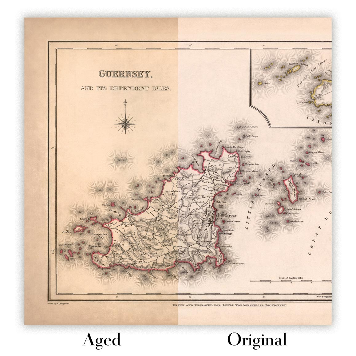
Map ageing
I have been asked hundreds of times over the years by customers if they could buy a map that looks even older.
Well, now you can, by selecting Aged before you add a map to your basket.
All the product photos you see on this page show the map in its Original form. This is what the map looks like today.
If you select Aged, I will age your map by hand, using a special and unique process developed through years of studying old maps, talking to researchers to understand the chemistry of aging paper, and of course... lots of practice!
If you're unsure, stick to the Original colour of the map. If you want something a bit darker and older looking, go for Aged.
Se non sei soddisfatto del tuo ordine per qualsiasi motivo, contattami per un rimborso senza problemi. Si prega di consultare la nostra politica di reso e rimborso per ulteriori informazioni.
Sono molto sicuro che ti piacerà la tua mappa restaurata o la stampa d'arte. Lo faccio dal 1984. Sono un venditore Etsy a 5 stelle. Ho venduto decine di migliaia di mappe e stampe d'arte e ho oltre 5.000 recensioni reali a 5 stelle.
Utilizzo un processo unico per restaurare mappe e opere d'arte che richiede molto tempo e lavoro. Trovare le mappe e le illustrazioni originali può richiedere mesi. Utilizzo tecnologia all'avanguardia e incredibilmente costosa per scannerizzare e restaurarle. Di conseguenza, garantisco che le mie mappe e stampe d'arte siano superiori alle altre - ecco perché posso offrire un rimborso senza problemi.
Quasi tutte le mie mappe e stampe d'arte sembrano fantastiche a grandi dimensioni (200 cm, 6,5 piedi+) e posso anche incorniciarle e consegnarle a te, tramite un corriere speciale per oggetti di grandi dimensioni. Contattami per discutere delle tue esigenze specifiche.
Or try searching for something!


