- Handmade locally. No import duty or tax
- FREE worldwide delivery
- 90-day returns & 5-year product guarantee
- Questions? WhatsApp me any time
Own a piece of history
7,000+ 5 star reviews


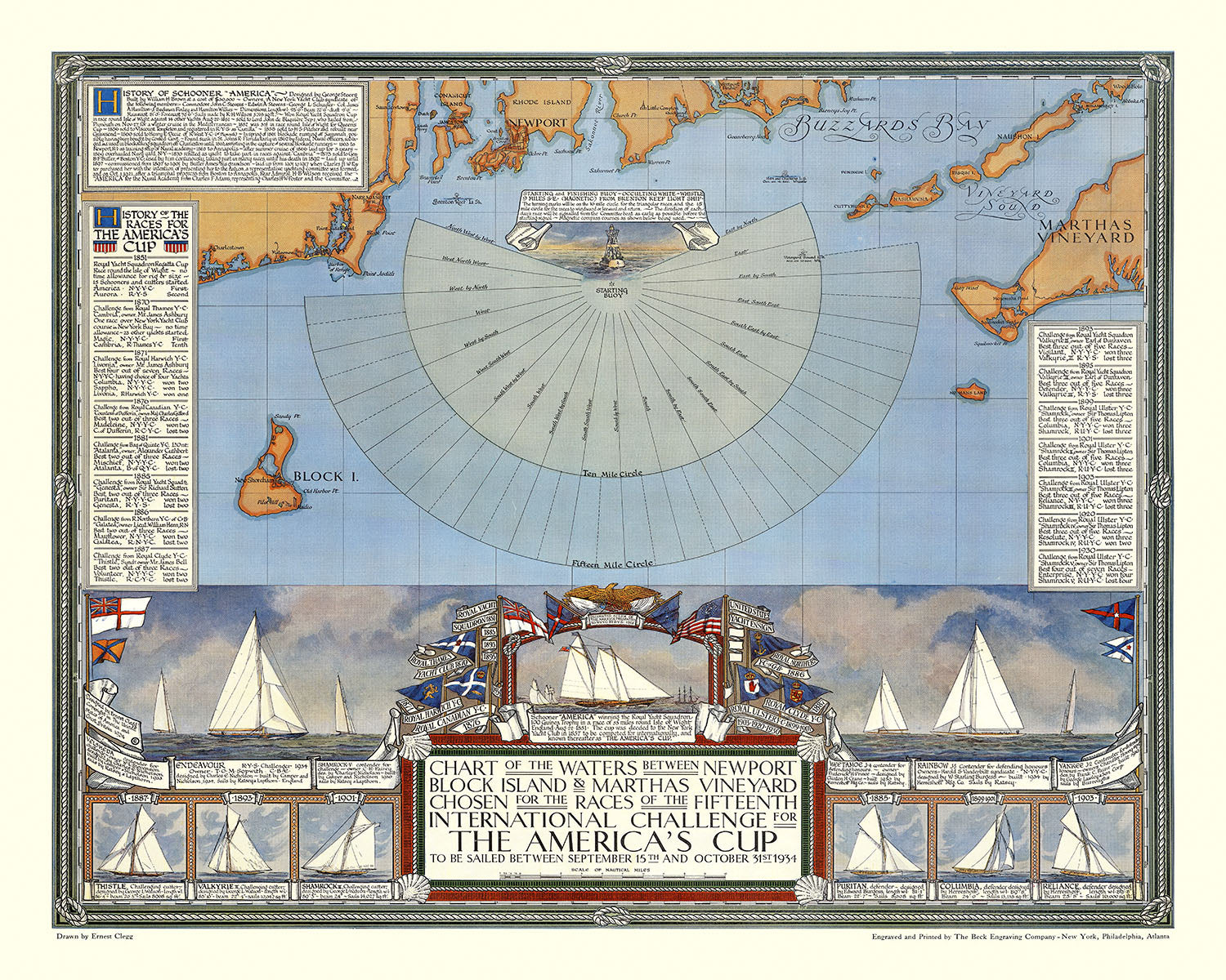
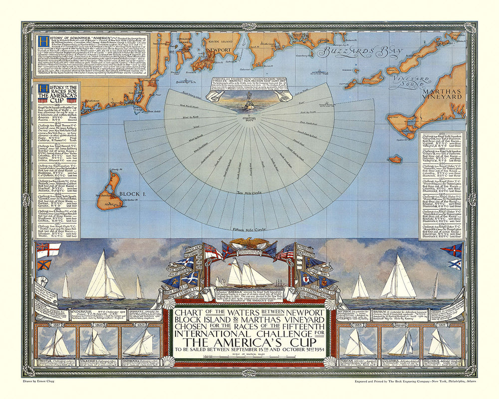
The Fifteenth International Challenge for the America's Cup, 1934, created by the esteemed mapmaker Ernest Clegg, is a stunning pictorial and nautical map that captures the excitement and grandeur of the 1934 America's Cup yacht races. This map is not just a navigational tool but a work of art that showcases the waters off the coasts of Rhode Island and Massachusetts, where the prestigious race took place. The decorative rope-form border and intricate illustrations make this map a visually captivating piece, while the detailed annotations provide rich historical context.
At the heart of the map is a decorative fan-like rendering of the compass directions from the starting buoy, within ten-mile and fifteen-mile circles. This central feature not only serves as a navigational aid but also adds a dynamic visual element to the map. Surrounding this are detailed illustrations of the competing yachts, including Endeavour, the 1934 challenger, and Rainbow, the defender, with the iconic Schooner America depicted prominently. These illustrations are accompanied by explanatory notes and the flags of the respective yachts, adding layers of historical and competitive context.
The map also includes a “History of the Races for the America's Cup,” listing past participants and results, as well as a “History of the Schooner ‘America.’” These historical annotations provide a comprehensive overview of the America's Cup's storied past, making this map not only a navigational tool but also a valuable historical document. The inclusion of these histories adds depth and context, making the map a treasure trove of information for yachting enthusiasts and historians alike.
Ernest Clegg's attention to detail and artistic flair are evident in every aspect of this map. Known for his detailed and artistic map designs, Clegg has created a piece that is both informative and aesthetically pleasing. The nautical rope border, the detailed compass rose, and the meticulous illustrations of the yachts all showcase Clegg's exceptional craftsmanship and dedication to his art. This map is a testament to Clegg's ability to blend functionality with beauty, making it a prized possession for any collector.
In addition to its visual appeal, the map provides practical information for navigators, including soundings (water depths) and other navigational aids. The coastal outlines of Rhode Island and Massachusetts are depicted with precision, highlighting key locations such as Newport and Martha's Vineyard. This combination of practical navigational information and rich historical context makes the Fifteenth International Challenge for the America's Cup, 1934, a unique and invaluable piece for anyone with an interest in maritime history and cartography.
Notable places on this map
- Towns and harbors:
- Newport, Rhode Island
- Martha's Vineyard, Massachusetts
- Islands:
- Block Island
- Water bodies:
- Buzzards Bay
- Navigational aids:
- Compass directions from the starting buoy
- Ten-mile and fifteen-mile circles indicating race boundaries
- Structures:
- Illustrations of competing yachts and their flags
- Topographical features:
- Coastal outlines of Rhode Island and Massachusetts
- Historical annotations:
- History of the Schooner America
- History of the races for the America's Cup
Notable Features & Landmarks
- Geographical area shown:
- Coastal waters of Rhode Island and Massachusetts, including specific areas like Newport and Martha's Vineyard.
- Historical, political, or geographical context:
- The map highlights the significance of the America's Cup yacht races in maritime history.
- It depicts the specific routes and starting points used in the 1934 races.
- Other interesting features:
- Detailed illustrations of the competing yachts, Endeavour and Rainbow.
- Historical notes on the Schooner America and previous America's Cup races.
- Decorative elements like the nautical rope border and compass rose.
- Annotations providing context and history of the America's Cup.
- Soundings (water depths) and navigational aids like the compass rose.
Historical and design context
- Name of the map: Fifteenth International Challenge for the America's Cup, 1934
- Extra notes:
- The map is a pictorial representation of the 1934 America's Cup yacht races.
- It includes a nautical rope-form decorative border.
- It showcases the waters of the Atlantic Ocean off the coasts of Rhode Island and Massachusetts, the location of the race.
- The upper portion features a decorative fan-like rendering of the compass directions from the starting buoy, within a ten-mile circle and a fifteen-mile circle.
- The cartouche includes images of previous America's Cup yachts and their flags, accompanied by explanatory notes.
- It features images of Endeavour, the 1934 challenger, and Rainbow, the defender, with the Schooner America depicted in the middle.
- The map provides a “History of the Races for the America's Cup,” listing past participants and results, as well as a “History of the Schooner ‘America.’”
- Ernest Clegg issued a limited edition of this print, slightly larger in size and signed by him.
- Date of creation: 1934
- Mapmaker or publisher: Ernest Clegg
- Ernest Clegg was known for his detailed and artistic map designs.
- Topics and themes:
- Nautical and maritime themes, focusing on the America's Cup yacht races.
- Historical context of the America's Cup and its participants.
- Design or style:
- The map has a decorative, pictorial style with nautical elements.
- It includes a detailed compass rose and historical annotations.
- Historical significance:
- The map commemorates the Fifteenth International Challenge for the America's Cup, a significant event in yachting history.
- It provides historical insights into past races and participants.
Please double check the images to make sure that a specific town or place is shown on this map. You can also get in touch and ask us to check the map for you.
This map looks great at every size, but I always recommend going for a larger size if you have space. That way you can easily make out all of the details.
This map looks amazing at sizes all the way up to 70in (180cm). If you are looking for a larger map, please get in touch.
Please note: the labels on this map are hard to read if you order a map that is 20in (50cm) or smaller. The map is still very attractive, but if you would like to read the map easily, please buy a larger size.
The model in the listing images is holding the 16x20in (40x50cm) version of this map.
The fifth listing image shows an example of my map personalisation service.
If you’re looking for something slightly different, check out my collection of the best old maps to see if something else catches your eye.
Please contact me to check if a certain location, landmark or feature is shown on this map.
This would make a wonderful birthday, Christmas, Father's Day, work leaving, anniversary or housewarming gift for someone from the areas covered by this map.
This map is available as a giclée print on acid free archival matte paper, or you can buy it framed. The frame is a nice, simple black frame that suits most aesthetics. Please get in touch if you'd like a different frame colour or material. My frames are glazed with super-clear museum-grade acrylic (perspex/acrylite), which is significantly less reflective than glass, safer, and will always arrive in perfect condition.
This map is also available as a float framed canvas, sometimes known as a shadow gap framed canvas or canvas floater. The map is printed on artist's cotton canvas and then stretched over a handmade box frame. We then "float" the canvas inside a wooden frame, which is available in a range of colours (black, dark brown, oak, antique gold and white). This is a wonderful way to present a map without glazing in front. See some examples of float framed canvas maps and explore the differences between my different finishes.
For something truly unique, this map is also available in "Unique 3D", our trademarked process that dramatically transforms the map so that it has a wonderful sense of depth. We combine the original map with detailed topography and elevation data, so that mountains and the terrain really "pop". For more info and examples of 3D maps, check my Unique 3D page.
For most orders, delivery time is about 3 working days. Personalised and customised products take longer, as I have to do the personalisation and send it to you for approval, which usually takes 1 or 2 days.
Please note that very large framed orders usually take longer to make and deliver.
If you need your order to arrive by a certain date, please contact me before you order so that we can find the best way of making sure you get your order in time.
I print and frame maps and artwork in 23 countries around the world. This means your order will be made locally, which cuts down on delivery time and ensures that it won't be damaged during delivery. You'll never pay customs or import duty, and we'll put less CO2 into the air.
All of my maps and art prints are well packaged and sent in a rugged tube if unframed, or surrounded by foam if framed.
I try to send out all orders within 1 or 2 days of receiving your order, though some products (like face masks, mugs and tote bags) can take longer to make.
If you select Express Delivery at checkout your order we will prioritise your order and send it out by 1-day courier (Fedex, DHL, UPS, Parcelforce).
Next Day delivery is also available in some countries (US, UK, Singapore, UAE) but please try to order early in the day so that we can get it sent out on time.
My standard frame is a gallery style black ash hardwood frame. It is simple and quite modern looking. My standard frame is around 20mm (0.8in) wide.
I use super-clear acrylic (perspex/acrylite) for the frame glass. It's lighter and safer than glass - and it looks better, as the reflectivity is lower.
Six standard frame colours are available for free (black, dark brown, dark grey, oak, white and antique gold). Custom framing and mounting/matting is available if you're looking for something else.
Most maps, art and illustrations are also available as a framed canvas. We use matte (not shiny) cotton canvas, stretch it over a sustainably sourced box wood frame, and then 'float' the piece within a wood frame. The end result is quite beautiful, and there's no glazing to get in the way.
All frames are provided "ready to hang", with either a string or brackets on the back. Very large frames will have heavy duty hanging plates and/or a mounting baton. If you have any questions, please get in touch.
See some examples of my framed maps and framed canvas maps.
Alternatively, I can also supply old maps and artwork on canvas, foam board, cotton rag and other materials.
If you want to frame your map or artwork yourself, please read my size guide first.
My maps are extremely high quality reproductions of original maps.
I source original, rare maps from libraries, auction houses and private collections around the world, restore them at my London workshop, and then use specialist giclée inks and printers to create beautiful maps that look even better than the original.
My maps are printed on acid-free archival matte (not glossy) paper that feels very high quality and almost like card. In technical terms the paper weight/thickness is 10mil/200gsm. It's perfect for framing.
I print with Epson ultrachrome giclée UV fade resistant pigment inks - some of the best inks you can find.
I can also make maps on canvas, cotton rag and other exotic materials.
Learn more about The Unique Maps Co.
Map personalisation
If you're looking for the perfect anniversary or housewarming gift, I can personalise your map to make it truly unique. For example, I can add a short message, or highlight an important location, or add your family's coat of arms.
The options are almost infinite. Please see my map personalisation page for some wonderful examples of what's possible.
To order a personalised map, select "personalise your map" before adding it to your basket.
Get in touch if you're looking for more complex customisations and personalisations.
Map ageing
I have been asked hundreds of times over the years by customers if they could buy a map that looks even older.
Well, now you can, by selecting Aged before you add a map to your basket.
All the product photos you see on this page show the map in its Original form. This is what the map looks like today.
If you select Aged, I will age your map by hand, using a special and unique process developed through years of studying old maps, talking to researchers to understand the chemistry of aging paper, and of course... lots of practice!
If you're unsure, stick to the Original colour of the map. If you want something a bit darker and older looking, go for Aged.
If you are not happy with your order for any reason, contact me and I'll get it fixed ASAP, free of charge. Please see my returns and refund policy for more information.
I am very confident you will like your restored map or art print. I have been doing this since 1984. I'm a 5-star Etsy seller. I have sold tens of thousands of maps and art prints and have over 5,000 real 5-star reviews. My work has been featured in interior design magazines, on the BBC, and on the walls of dozens of 5-star hotels.
I use a unique process to restore maps and artwork that is massively time consuming and labour intensive. Hunting down the original maps and illustrations can take months. I use state of the art and eye-wateringly expensive technology to scan and restore them. As a result, I guarantee my maps and art prints are a cut above the rest. I stand by my products and will always make sure you're 100% happy with what you receive.
Almost all of my maps and art prints look amazing at large sizes (200cm, 6.5ft+) and I can frame and deliver them to you as well, via special oversized courier. Contact me to discuss your specific needs.
Or try searching for something!


