


Rare Old Map of County Meath by Samuel Lewis, 1844: Navan, Trim, Kells, Athboy, Hill of Tara
20% off 2 — 33% off 3
Add any two eligible items to your bag to receive 20% off. Add a third and it will be complimentary (equivalent to 33% off when purchasing three).
No code needed — the offer applies automatically at checkout.
Valid on all standard maps and fine art prints. You can mix and match any designs.
If you’d like to ship items to multiple addresses, please contact us before placing your order.
Custom and bespoke commissions are excluded.
Contact us if you have any questions
 Designed in London Made in Canada
Designed in London • Made in Canada
Designed in London Made in Canada
Designed in London • Made in Canada

Choose your size
Choose your finish


(More info)
Gift message & custom finish

If you want to add a gift message, or a finish (jigsaw, aluminium board, etc.) that is not available here, please request it in the "order note" when you check out.
Every order is custom made, so if you need the size adjusted slightly, or printed on an unusual material, just let us know. We've done thousands of custom orders over the years, so there's (almost) nothing we can't manage.
You can also contact us before you order, if you prefer!

- Made locally for fast, safe delivery
- No import duty or hidden fees
- Need advice? Message us on WhatsApp
Own a piece of history
7,000+ 5 star reviews


This meticulously crafted Old Map of Meath by Samuel Lewis in 1844 is a captivating piece of history that offers a glimpse into the past. With its exquisite details and intricate cartography, this map is a must-have for any history enthusiast or collector.
Measuring [insert dimensions], this map showcases the historical boundaries of County Meath, Ireland, as they were in 1844. It provides a fascinating perspective on the region's landscape, towns, and landmarks during that era. While some modern cities may not be featured on this map, it is an exciting opportunity to discover earlier names of existing locations or explore settlements that have evolved over time.
The Old Map of Meath by Samuel Lewis, 1844, presents a wealth of information and highlights the historical significance of the region. It offers a unique lens into the past, allowing you to trace the footsteps of generations long gone. Whether you are a history buff, a genealogist, or simply appreciate the beauty of antique maps, this piece is sure to captivate and inspire.
Notable Settlements Founded Before 1840:
Navan (c. 6th century): Navan, the largest town in County Meath, has a rich history dating back to ancient times. It was an important center during the medieval period and is known for its historical sites, including the Navan Fort and the ruins of Navan Castle.
Trim (c. 5th century): Trim is renowned for its well-preserved medieval structures, particularly Trim Castle, the largest Anglo-Norman castle in Ireland. This charming town also boasts St. Patrick's Cathedral, which dates back to the 12th century.
Kells (c. 6th century): Kells is famous for its association with the Book of Kells, an illuminated manuscript of the four Gospels created around the 9th century. The town's rich monastic heritage is evident in its numerous ancient ruins and Celtic crosses.
Athboy (c. 12th century): Athboy is steeped in history and was once a significant market town. It features the remains of Athboy Franciscan Friary, a medieval monastery founded in the 13th century.
Hill of Tara (Prehistoric): The Hill of Tara holds immense archaeological and historical importance. It was the ancient seat of the High Kings of Ireland and is dotted with ancient monuments and burial mounds.
Duleek (c. 5th century): Duleek is one of the oldest towns in Ireland, with a history dating back to early Christian times. It boasts notable landmarks such as Duleek Abbey, a monastic site founded in the 5th century.
Ratoath (c. 13th century): Ratoath is home to the ruins of Ratoath Castle, a medieval fortress built in the 13th century. The town also features the historic St. Mary's Church, which dates back to the 12th century.
Dunshaughlin (c. 13th century): Dunshaughlin has a rich medieval heritage, with remnants of its past visible in the ruins of Dunshaughlin Castle. The town's historic St. Seachnall's Church dates back to the 10th century.
Oldcastle (c. 13th century): Oldcastle is known for its connection to the legendary figure of Sir Oliver Cromwell. The town features the impressive remains of Oldcastle Motte and Bailey, a medieval fortification.
Enfield (c. 18th century): Enfield is a picturesque town that grew around the construction of the Royal Canal in the late 18th century. It offers a charming blend of history and natural beauty.
Slane (c. 6th century): Slane is famous for Slane Castle, an 18th-century mansion set amidst stunning parkland. The town's history stretches back to ancient times, and it is associated with the introduction of Christianity to Ireland.
Ashbourne (c. 17th century): Ashbourne is notable for its involvement in the 1916 Easter Rising, a pivotal event in Irish history. The town's historical significance is commemorated through various monuments and plaques.
Laytown (c. 18th century): Laytown is a coastal town known for its beautiful beach and annual horse racing event, which has been held since the 19th century. It offers a delightful seaside escape.
Dunboyne (c. 18th century): Dunboyne is a vibrant town with a rich equestrian heritage. It hosts the prestigious Fairyhouse Racecourse, which has been a prominent venue for horse racing since the 19th century.
Mornington (c. 18th century): Mornington is a charming seaside village known for its scenic coastline and historical Martello tower, built during the Napoleonic Wars.
Clonee (c. 17th century): Clonee is a rapidly growing town that has witnessed significant development in recent years. It offers a blend of modern amenities and glimpses of its historical past.
Johnstown (c. 18th century): Johnstown is a picturesque village with a tranquil atmosphere. It features Johnstown Castle, an elegant 19th-century mansion surrounded by beautiful gardens.
Dunshaughlin (c. 13th century): Dunshaughlin has a rich medieval heritage, with remnants of its past visible in the ruins of Dunshaughlin Castle. The town's historic St. Seachnall's Church dates back to the 10th century.
Oldcastle (c. 13th century): Oldcastle is known for its connection to the legendary figure of Sir Oliver Cromwell. The town features the impressive remains of Oldcastle Motte and Bailey, a medieval fortification.
Enfield (c. 18th century): Enfield is a picturesque town that grew around the construction of the Royal Canal in the late 18th century. It offers a charming blend of history and natural beauty.
Slane (c. 6th century): Slane is famous for Slane Castle, an 18th-century mansion set amidst stunning parkland. The town's history stretches back to ancient times, and it is associated with the introduction of Christianity to Ireland.
Ashbourne (c. 17th century): Ashbourne is notable for its involvement in the 1916 Easter Rising, a pivotal event in Irish history. The town's historical significance is commemorated through various monuments and plaques.
Laytown (c. 18th century): Laytown is a coastal town known for its beautiful beach and annual horse racing event, which has been held since the 19th century. It offers a delightful seaside escape.
Duleek (c. 5th century): Duleek is one of the oldest towns in Ireland, with a history dating back to early Christian times. It boasts notable landmarks such as Duleek Abbey, a monastic site founded in the 5th century.
Ratoath (c. 13th century): Ratoath is home to the ruins of Ratoath Castle, a medieval fortress built in the 13th century. The town also features the historic St. Mary's Church, which dates back to the 12th century.
Kells (c. 6th century): Kells is famous for its association with the Book of Kells, an illuminated manuscript of the four Gospels created around the 9th century. The town's rich monastic heritage is evident in its numerous ancient ruins and Celtic crosses.
Athboy (c. 12th century): Athboy is steeped in history and was once a significant market town. It features the remains of Athboy Franciscan Friary, a medieval monastery founded in the 13th century.
Notable Boundaries, Rivers, and Natural Phenomena:
River Boyne: The River Boyne flows through County Meath, carving a picturesque valley and playing a significant role in the region's history. It is renowned for the Battle of the Boyne, a pivotal event in Irish and European history.
Hill of Tara: The Hill of Tara is a prominent archaeological site and ancient ceremonial complex. It offers stunning views of the surrounding countryside and is associated with Irish mythology and the High Kings of Ireland.
Loughcrew Cairns: Loughcrew Cairns, also known as the Hills of the Witch, is a collection of Neolithic passage tombs dating back over 5,000 years. These ancient burial sites are a testament to the region's prehistoric heritage.
Slane Castle: Slane Castle, located on the banks of the River Boyne, is a magnificent 18th-century mansion surrounded by sprawling parkland. It hosts concerts and events, adding to its allure.
Royal Canal: The Royal Canal, which passes through County Meath, is a historic waterway that played a vital role in transportation and trade during the 18th and 19th centuries. It offers scenic walks and boating opportunities.
Historical Events in County Meath (1800-1850):
The 1798 Rebellion: County Meath witnessed significant involvement in the 1798 Rebellion, a rebellion against British rule in Ireland. The rebellion had a profound impact on the region, leading to increased tensions and subsequent events.
The Great Famine (1845-1852): County Meath, like the rest of Ireland, experienced the devastating effects of the Great Famine. This period of widespread hunger and hardship had a lasting impact on the region's population and social fabric.
The Catholic Emancipation Act (1829): The Catholic Emancipation Act, passed in 1829, granted political rights to Catholics in Ireland. This legislation had a profound impact on County Meath, where Catholicism played a significant role in the community.
The Tithe War (1830s): The Tithe War, a series of protests against the payment of tithes to the Anglican Church of Ireland, also affected County Meath. These conflicts reflected the tensions between different religious communities in the region.
The Rise of Irish Nationalism: The early to mid-19th century witnessed a surge in Irish nationalism, with County Meath playing a role in the growing movement for Irish independence. This period saw the emergence of influential figures and organizations advocating for self-governance.
Note: This map is a historical representation and does not include modern cities or indicate current boundaries.
Please double check the images to make sure that a specific town or place is shown on this map. You can also get in touch and ask us to check the map for you.
This map looks great at all sizes, but it looks even better when printed large.
I can create beautiful, large prints of this map up to 50in (127cm). Please get in touch if you're looking for larger, customised or different framing options.
The model in the listing images is holding the 16x20in (40.5x51cm) version of this map.
The fifth listing image shows an example of my map personalisation service.
If you’re looking for something slightly different, check out my main collection of UK and Ireland maps.
Please contact me to check if a certain location, landmark or feature is shown on this map.
This would make a wonderful birthday, Christmas, Father's Day, work leaving, anniversary or housewarming gift for someone from the areas covered by this map.
This map is available as a giclée print on acid free archival matte paper, or you can buy it framed. The frame is a nice, simple black frame that suits most aesthetics. Please get in touch if you'd like a different frame colour or material. My frames are glazed with super-clear museum-grade acrylic (perspex/acrylite), which is significantly less reflective than glass, safer, and will always arrive in perfect condition.
This map is also available as a float framed canvas, sometimes known as a shadow gap framed canvas or canvas floater. The map is printed on artist's cotton canvas and then stretched over a handmade box frame. We then "float" the canvas inside a wooden frame, which is available in a range of colours (black, dark brown, oak, antique gold and white). This is a wonderful way to present a map without glazing in front. See some examples of float framed canvas maps and explore the differences between my different finishes.
For something truly unique, this map is also available in "Unique 3D", our trademarked process that dramatically transforms the map so that it has a wonderful sense of depth. We combine the original map with detailed topography and elevation data, so that mountains and the terrain really "pop". For more info and examples of 3D maps, check my Unique 3D page.
Many of our maps and art prints are chosen as thoughtful gifts for homes, offices, studies and meaningful places.
Choose a framed option for the easiest ready-to-hang gift, or choose an unframed print if the recipient may prefer to select their own frame.
We make orders locally in 23 countries around the world, so gifts can often be produced close to the recipient. This helps them arrive faster, travel more safely, and avoid customs or import duty surprises.
- We can deliver directly to the recipient
- Framed pieces arrive ready to hang
- Unframed prints are carefully packed in a strong protective tube
- Almost every order is made locally, for faster, safer gifting
- 90-day returns give the recipient time to decide
If you are not sure what to choose, please contact us. We can help you pick the right map, size, finish or delivery option.
Most orders are made locally and delivered in around 2–3 working days, depending on the product, size and destination.
We print and frame maps and artwork in 23 countries around the world, so your order is usually made close to you or your recipient. That means faster delivery, less time in transit, and no customs or import duty surprises.
Personalised and customised pieces usually take an extra 1–2 working days, because we prepare your design and send it to you for approval before printing.
Very large framed orders can take a little longer, as they need extra care in production and delivery.
Every order is carefully packaged: unframed prints are sent in a strong protective tube, while framed pieces are securely packed with protective materials around the frame.
If you need your order by a particular date, please contact us before ordering. We’ll check the best production route and delivery option for your location.
Express delivery is available at checkout for most countries. Next-day delivery is available in the UK, US, Singapore and the UAE.
Your order is covered by our 90-day returns policy and 10-year guarantee.
Our standard frame is a gallery-style black ash hardwood frame, with a simple, modern look. It is approximately 20mm (0.8in) wide. You can also view some lovely customer photos of framed maps and art.
We use super-clear acrylic glazing, also known as Perspex or Acrylite, instead of traditional glass. It is lighter, safer, and has lower reflectivity, giving the artwork a clearer, cleaner appearance.
Six standard frame colours are available at no extra cost: black, dark brown, dark grey, oak, white, and antique gold. Custom framing and mounting/matting is also available for customers looking for something more specific.
Most maps, art prints, and illustrations are also available as a framed canvas. We use matte cotton canvas, stretch it over a sustainably sourced wooden box frame, and then float the piece within a wooden outer frame. The finished result is beautifully presented, with no glazing between you and the artwork.
All frames are supplied ready to hang, with either string or brackets fitted to the back. Very large frames will include heavy-duty hanging plates and/or a mounting baton. If you have any questions, please get in touch.
We can also supply old maps and artwork on canvas, foam board, cotton rag, and other materials.
If you would prefer to frame your map or artwork yourself, please read our size guide before ordering.
My maps are extremely high quality reproductions of original maps.
I source original, rare maps from libraries, auction houses and private collections around the world, restore them at my London workshop, and then use specialist giclée inks and printers to create beautiful maps that look even better than the original.
My maps are printed on acid-free archival matte (not glossy) paper that feels very high quality and almost like card. In technical terms the paper weight/thickness is 10mil/200gsm. It's perfect for framing.
I print with Epson ultrachrome giclée UV fade resistant pigment inks - some of the best inks you can find.
I can also make maps on canvas, cotton rag and other exotic materials.
Learn more about The Unique Maps Co.
Map personalisation
If you're looking for the perfect anniversary or housewarming gift, I can personalise your map to make it truly unique. For example, I can add a short message, or highlight an important location, or add your family's coat of arms.
The options are almost infinite. Please see my map personalisation page for some wonderful examples of what's possible.
To order a personalised map, select "personalise your map" before adding it to your basket.
Get in touch if you're looking for more complex customisations and personalisations.
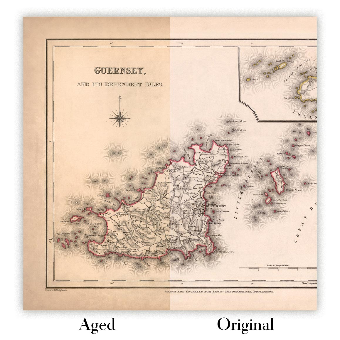
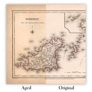
Map ageing
I have been asked hundreds of times over the years by customers if they could buy a map that looks even older.
Well, now you can, by selecting Aged before you add a map to your basket.
All the product photos you see on this page show the map in its Original form. This is what the map looks like today.
If you select Aged, I will age your map by hand, using a special and unique process developed through years of studying old maps, talking to researchers to understand the chemistry of aging paper, and of course... lots of practice!
If you're unsure, stick to the Original colour of the map. If you want something a bit darker and older looking, go for Aged.
If you are not happy with your order for any reason, contact me and I'll get it fixed ASAP, free of charge. Please see my returns and refund policy for more information.
I am very confident you will like your restored map or art print. I have been doing this since 1984. I'm a 5-star Etsy seller. I have sold tens of thousands of maps and art prints and have over 5,000 real 5-star reviews. My work has been featured in interior design magazines, on the BBC, and on the walls of dozens of 5-star hotels.
I use a unique process to restore maps and artwork that is massively time consuming and labour intensive. Hunting down the original maps and illustrations can take months. I use state of the art and eye-wateringly expensive technology to scan and restore them. As a result, I guarantee my maps and art prints are a cut above the rest. I stand by my products and will always make sure you're 100% happy with what you receive.
Almost all of my maps and art prints look amazing at large sizes (200cm, 6.5ft+) and I can frame and deliver them to you as well, via special oversized courier. Contact me to discuss your specific needs.
Or try searching for something!


