


Mapa antiguo de Flintshire, Gales, de Lewis, 1844: Flint, Mold, Holywell, estuario del Dee, colinas Clwydian
20% de descuento en 2 — 33% de descuento en 3
Añade dos artículos elegibles a tu carrito para recibir 20% de descuento. Añade un tercero y será complementario (equivalente a 33% de descuento al comprar tres).
No se necesita código — la oferta se aplica automáticamente al finalizar la compra.
Válido en todos los mapas estándar y impresiones de arte fino. Puedes mezclar y combinar cualquier diseño.
Si deseas enviar artículos a múltiples direcciones, por favor contáctanos antes de realizar tu pedido.
Las comisiones personalizadas y a medida están excluidas.
Contáctanos si tienes alguna pregunta
 Diseñado en Londres Hecho en Canada
Diseñado en Londres • Hecho en Canada
Diseñado en Londres Hecho en Canada
Diseñado en Londres • Hecho en Canada

Choose your size
Choose your finish


(Más información)
Mensaje de regalo y acabado personalizado

Si deseas agregar un mensaje de regalo, o un acabado (rompecabezas, tablero de aluminio, etc.) que no esté disponible aquí, por favor solicítalo en la "nota del pedido" cuando realices la compra.
Cada pedido es hecho a medida, así que si necesitas que el tamaño se ajuste ligeramente, o que se imprima en un material inusual, háznoslo saber. Hemos realizado miles de pedidos personalizados a lo largo de los años, así que hay (casi) nada que no podamos gestionar.
También puedes contactarnos antes de hacer tu pedido, ¡si lo prefieres!

- Made locally for fast, safe delivery
- No import duty or hidden fees
- Need advice? Message us on WhatsApp
Own a piece of history
7,000+ 5 star reviews


El condado de Flintshire, creado por R. Creighton y grabado por J. & C. Walker, apareció en 1844 dentro del célebre Atlas to the Topographical Dictionary of England and Wales de Samuel Lewis & Co. Concebido tanto como obra de referencia erudita como elegante guía visual, combina una precisa delimitación política con un sutil retrato del paisaje. Los contornos coloreados a mano distinguen los límites del condado y de las uniones, mientras que ciudades, boroughs y market towns se señalan con claridad a lo largo de una red de caminos principales y de incipientes ferrocarriles. La inusual orientación—con el norte hacia la parte superior derecha—invita a una nueva lectura de la zona fronteriza entre Gales e Inglaterra. Con su refinada tipografía y sus símbolos cuidadosamente escalonados para asentamientos y hitos, la hoja encarna un ideal victoriano de mediados de siglo: autorizada, legible y discretamente hermosa, pero atenta a la complejidad del gobierno local y del terreno.
El relieve se representa con hachuras disciplinadas, guiando la mirada a lo largo de la espina de las crestas del altiplano que descienden hacia el estuario del Dee. Las alturas clwydianas alrededor de Mold y el terreno accidentado hacia Halkyn Mountain emergen en un claroscuro contenido, mientras que los cursos fluviales y los canales recorren los valles hasta la costa. El cartógrafo traza el sinuoso Dee a medida que se ensancha en marismas y puertos sometidos a la marea, umbral marítimo que moldeó la economía de Flintshire. Un encarte aísla una porción separada del condado dentro del County of Salop, aclarando la peculiar geografía de Maelor y otros enclaves que desconcertaban por igual a administradores y viajeros. Los símbolos de puentes, transbordadores y cruces de caminos marcan la red, y la representación graduada de caminos y ferrocarriles muestra cómo el movimiento terrestre se concentraba en corredores que respetan tanto la pendiente como la costumbre histórica.
Los nombres de los asentamientos anclan la narrativa del condado. Flint, con su castillo y su frente fluvial, se sitúa frente a la orilla inglesa, centinela sobre el Dee. Mold, históricamente la capital del condado, reúne caminos desde las colinas y está rodeada de aldeas cuyo destino ascendió con la cantería y el plomo. Holywell, célebre por St Winefride’s Well, aparece como imán devocional y comercial, mientras que Connah’s Quay señala el crecimiento de modernas instalaciones portuarias en aguas sometidas a la marea. Caerwys, una market town más pequeña, marca el corazón rural. Wrexham, justo más allá de la línea del condado, se cartografía como una potencia vecina, y sus conexiones subrayan la proximidad de Flintshire a una industria en auge. El grabado distingue boroughs de townships y anota las divisiones administrativas con discreta precisión, permitiendo al lector desentrañar de un vistazo las jerarquías cívicas y apreciar cómo la geografía moldeaba la jurisdicción.
Dibujado en un momento en que las Poor Law Unions reorganizaban la administración social y el capital ferroviario exploraba nuevos corredores, el mapa capta a Flintshire en el umbral de la transformación. Minas, fundiciones y canteras se concentraban a lo largo de cinturones minerales, mientras que las carreteras de peaje y los proyectados ferrocarriles de hierro buscaban los trayectos más cortos hacia desembarcaderos fluviales y muelles costeros. La navegación del Dee y los canales de enlace conectaban los mercados del interior con Liverpool y el mar de Irlanda, y la línea porosa de la frontera fomentaba el intercambio de mano de obra, ideas y mercancías con Cheshire y Denbighshire. La cuidadosa jerarquía de símbolos de Creighton hace legible este sistema administrativo y económico: los límites de las uniones, los confines de los boroughs y los contornos parroquiales se leen a contracorriente de colinas y cursos de agua, revelando cómo la política hubo de acomodarse al hecho físico. Es un condado a la vez ordenado e inquieto, preparado para la aceleración victoriana.
La autoría de R. Creighton y el soberbio trabajo al buril de J. & C. Walker confieren la exactitud que valoran los coleccionistas: márgenes tensos, rotulación equilibrada y cada límite vivo de intención. Samuel Lewis and Co., cuya Topographical Dictionary instruyó a una generación de lectores, vinculó tal arte con la erudición, publicando un atlas cuyos 57 mapas de condados y regiones cartografiaban no solo el espacio sino el significado. En esta hoja de Flintshire, su programa se completa: un condado presentado como un archivo vivo, donde el patrimonio eclesiástico, la ambición industrial y el orden cívico son legibles de un vistazo. La ligera inclinación de la brújula hacia el noreste, la sutil coloración de las jurisdicciones y el sobrio sombreado por rayado encarnan una convicción victoriana en la claridad sin ostentación. Como documento histórico, fija un momento de mediados del siglo XIX; como obra de diseño, sigue siendo sorprendentemente moderna.
Ciudades y localidades en este mapa
- Wrexham (población moderna aprox. 65,000)
- Flint (población moderna aprox. 40,000)
- Mold (población moderna aprox. 10,500)
- Caerwys (población moderna aprox. 1,200)
- Holywell (población moderna aprox. 10,000)
- Connah's Quay (población moderna aprox. 27,000)
Características destacadas y puntos de interés
- Contornos detallados de los límites políticos.
- Las principales carreteras y ferrocarriles que conectan diversas localidades.
- Ríos y canales significativos marcados en todo Flintshire.
- Mapa insertado que detalla una parte de Flintshire en el condado de Salop.
- Anotaciones de diversos puntos de interés, incluidas localidades y principales divisiones administrativas.
- Relieve representado con rayado, que indica rasgos topográficos.
Contexto histórico y de diseño
- Creado por R. Creighton y grabado por J. & C. Walker; publicado en 1844 como parte del Atlas to the Topographical Dictionary of England and Wales.
- Editor: Samuel Lewis and Co., un notable editor londinense.
- Resumen del mapa: un mapa político y físico detallado de Flintshire, coloreado a mano en el contorno, que muestra unions, ciudades, boroughs, localidades, carreteras, ferrocarriles y puntos de interés.
- Orientación: el norte se sitúa hacia la parte superior derecha.
- Contexto histórico: refleja el paisaje administrativo y cultural de Flintshire a mediados del siglo XIX dentro de una publicación más amplia que ilustra la historia local.
- Atributos físicos: forma parte de un atlas encuadernado en tela verde oliva en relieve con letras doradas, lo que indica propósito erudito y artesanía.
- Legado del cartógrafo: Samuel Lewis contribuyó de manera significativa a la cartografía del siglo XIX de las Islas Británicas, publicando recursos exhaustivos que incluían 57 mapas.
- Temas clave: sirve tanto como referencia geográfica como documento histórico, destacando la organización administrativa y los aspectos culturales.
Por favor, compruebe cuidadosamente las imágenes para asegurarse de que una ciudad o lugar específico aparece en este mapa. También puede ponerse en contacto con nosotros y pedirnos que revisemos el mapa por usted.
Este mapa luce magnífico en cualquier tamaño, pero siempre recomiendo optar por un tamaño mayor si dispone de espacio. De ese modo podrá apreciar fácilmente todos los detalles.
Este mapa luce increíble en tamaños de hasta 50in (125cm). Si busca un mapa más grande, por favor póngase en contacto.
El modelo en las imágenes del anuncio sostiene la versión de 16x20in (40x50cm) de este mapa.
La quinta imagen del anuncio muestra un ejemplo de mi servicio de personalización de mapas.
Si busca algo ligeramente diferente, eche un vistazo a mi colección de los mejores mapas antiguos para ver si algo más llama su atención.
Por favor, contácteme para comprobar si un determinado lugar, punto de referencia o elemento aparece en este mapa.
Sería un regalo maravilloso de cumpleaños, Navidad, Día del Padre, despedida de trabajo, aniversario o inauguración de casa para alguien de las zonas cubiertas por este mapa.
Este mapa está disponible como impresión giclée sobre papel mate de archivo libre de ácido, o puede adquirirlo enmarcado. El marco es negro, sencillo y elegante, y combina con la mayoría de estilos decorativos. Póngase en contacto si desea un color o material de marco diferente. Mis marcos llevan acristalamiento de acrílico de grado museo, de gran transparencia (perspex/acrylite), significativamente menos reflectante que el vidrio, más seguro y que siempre llegará en perfectas condiciones.
This map is also available as a float framed canvas, sometimes known as a shadow gap framed canvas or canvas floater. The map is printed on artist's cotton canvas and then stretched over a handmade box frame. We then "float" the canvas inside a wooden frame, which is available in a range of colours (black, dark brown, oak, antique gold and white). This is a wonderful way to present a map without glazing in front. See some examples of float framed canvas maps and explore the differences between my different finishes.
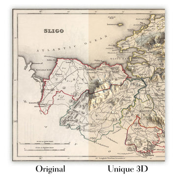
For something truly unique, this map is also available in "Unique 3D", our trademarked process that dramatically transforms the map so that it has a wonderful sense of depth. We combine the original map with detailed topography and elevation data, so that mountains and the terrain really "pop". For more info and examples of 3D maps, check my Unique 3D page.
Many of our maps and art prints are chosen as thoughtful gifts for homes, offices, studies and meaningful places.
Choose a framed option for the easiest ready-to-hang gift, or choose an unframed print if the recipient may prefer to select their own frame.
We make orders locally in 23 countries around the world, so gifts can often be produced close to the recipient. This helps them arrive faster, travel more safely, and avoid customs or import duty surprises.
- We can deliver directly to the recipient
- Framed pieces arrive ready to hang
- Unframed prints are carefully packed in a strong protective tube
- Almost every order is made locally, for faster, safer gifting
- 90-day returns give the recipient time to decide
If you are not sure what to choose, please contact us. We can help you pick the right map, size, finish or delivery option.
Para la mayoría de los pedidos, el tiempo de entrega es de aproximadamente 3 días laborables. Los productos personalizados y a medida tardan más, ya que tengo que hacer la personalización y enviártelo para su aprobación, lo cual suele tardar 1 o 2 días.
Tenga en cuenta que los pedidos enmarcados muy grandes suelen tardar más en fabricarse y entregarse.
Si necesitas que tu pedido llegue para una fecha determinada, por favor contáctame antes de hacer el pedido para que podamos encontrar la mejor manera de asegurarnos de que recibas tu pedido a tiempo.
Imprimo y enmarco mapas y obras de arte en 23 países alrededor del mundo. Esto significa que tu pedido se fabricará localmente, lo que reduce el tiempo de entrega y asegura que no se dañe durante el envío. Nunca pagarás aranceles de aduana o impuestos de importación, y pondremos menos CO2 en el aire.
Todos mis mapas y impresiones artísticas están bien empaquetados y enviados en un tubo resistente si no están enmarcados, o rodeados de espuma si están enmarcados.
Intento enviar todos los pedidos dentro de 1 o 2 días después de recibir tu pedido, aunque algunos productos (como mascarillas, tazas y bolsas de tela) pueden tardar más en fabricarse.
Si seleccionas Entrega Exprés al finalizar la compra, priorizaremos tu pedido y lo enviaremos por mensajería de 1 día (Fedex, DHL, UPS, Parcelforce).
La entrega al día siguiente también está disponible en algunos países (EE. UU., Reino Unido, Singapur, EAU), pero por favor intenta hacer tu pedido temprano en el día para que podamos enviarlo a tiempo.
Mi marco estándar es un marco de madera de fresno negro estilo galería. Es simple y tiene un aspecto bastante moderno. Mi marco estándar tiene alrededor de 20 mm (0.8 in) de ancho.
Utilizo acrílico super claro (perspex/acrylite) para el vidrio del marco. Es más ligero y seguro que el vidrio, y se ve mejor, ya que la reflectividad es menor.
Seis colores de marco estándar están disponibles de forma gratuita (negro, marrón oscuro, gris oscuro, roble, blanco y oro antiguo).El enmarcado y montaje/matizado personalizado está disponible si buscas algo diferente.
La mayoría de los mapas, arte e ilustraciones también están disponibles como un lienzo enmarcado. Utilizamos lienzo de algodón mate (no brillante), lo estiramos sobre un marco de madera de caja de origen sostenible, y luego 'flotamos' la pieza dentro de un marco de madera. El resultado final es bastante hermoso, y no hay cristal que se interponga.
Todos los marcos se proporcionan "listos para colgar", con una cuerda o soportes en la parte posterior. Los marcos muy grandes tendrán placas de colgar de alta resistencia y/o un listón de montaje. Si tienes alguna pregunta, por favor ponte en contacto.
Mira algunos ejemplos de mis mapas enmarcados y mapas en lienzo enmarcados.
Alternativamente, también puedo proporcionar mapas antiguos y obras de arte en lienzo, tablero de espuma, papel de algodón y otros materiales.
Si deseas enmarcar tu mapa o obra de arte tú mismo, por favor lee mi guía de tamaños primero.
Mis mapas son reproducciones de mapas originales de altísima calidad.
Obtengo mapas originales y raros de bibliotecas, casas de subastas y colecciones privadas de todo el mundo, los restauro en mi taller de Londres y luego uso tintas e impresoras giclée especializadas para crear hermosos mapas que lucen incluso mejor que el original.
Mis mapas están impresos en papel de archivo mate (no brillante) sin ácido que se siente de muy alta calidad y casi como una tarjeta. En términos técnicos, el peso/grosor del papel es de 10 mil/200 g/m². Es perfecto para enmarcar.
Imprimo con tintas pigmentadas Epson ultrachrome giclée UV resistentes a la decoloración, algunas de las mejores tintas que puedes encontrar.
yo también puedo hacer mapas sobre lienzo, trapo de algodón y otros materiales exóticos.
Obtenga más información sobre The Unique Maps Co..
Personalización de mapas
Si está buscando el regalo perfecto de aniversario o inauguración de la casa, puedo personalizar su mapa para hacerlo verdaderamente único. Por ejemplo, puedo agregar un mensaje corto, resaltar una ubicación importante o agregar el escudo de armas de su familia.
Las opciones son casi infinitas. Por favor mira mi página de personalización de mapas para ver algunos maravillosos ejemplos de lo que es posible.
Para pedir un mapa personalizado, seleccione "personalizar su mapa" antes de agregarlo a su carrito.
Ponerse en contacto si buscas personalizaciones y personalizaciones más complejas.
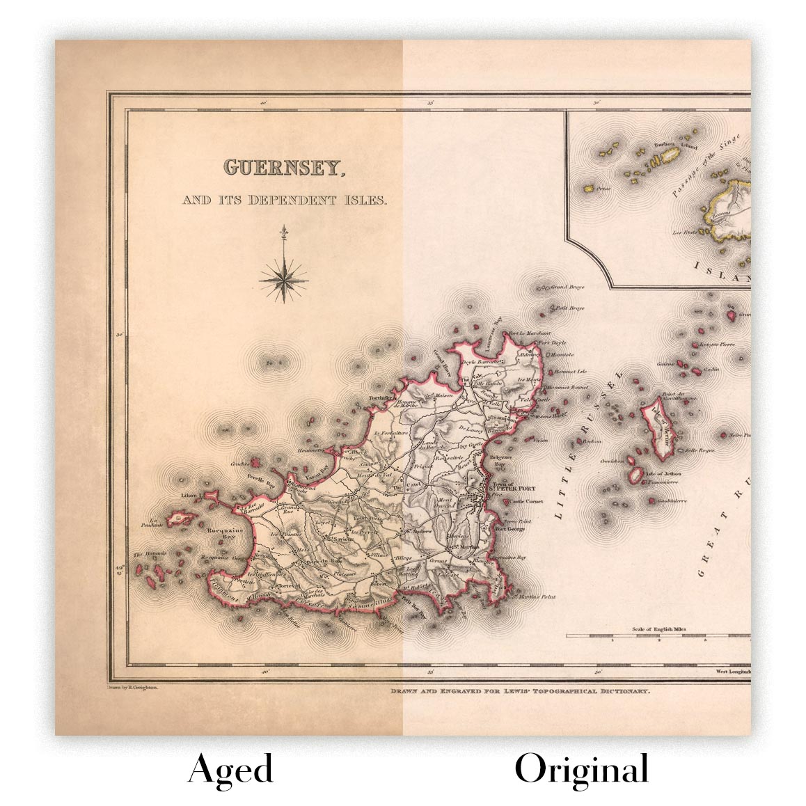
Envejecimiento del mapa
A lo largo de los años, los clientes me han preguntado cientos de veces si podían comprar un mapa que se viera uniforme. más viejo.
Bueno, ahora puedes hacerlo seleccionando Envejecido antes de agregar un mapa a tu carrito.
Todas las fotografías de productos que ve en esta página muestran el mapa en su forma original. Así es como se ve el mapa hoy.
Si selecciona Envejecido, envejeceré su mapa a mano, usando un proceso especial y único desarrollado a través de años de estudiar mapas antiguos, hablar con investigadores para comprender la química del envejecimiento del papel y, por supuesto... ¡mucha práctica!
Si no estás seguro, quédate con el color original del mapa. Si quieres algo un poco más oscuro y más viejo buscando, opte por Envejecido.
Si no estás satisfecho con tu pedido por cualquier motivo, contáctame para un reembolso sin complicaciones. Por favor, consulta nuestra política de devoluciones y reembolsos para más información.
Estoy muy seguro de que te gustará tu mapa o impresión artística restaurada. He estado haciendo esto desde 1984. Soy un vendedor de 5 estrellas en Etsy. He vendido decenas de miles de mapas e impresiones artísticas y tengo más de 5,000 opiniones reales de 5 estrellas.
Utilizo un proceso único para restaurar mapas y obras de arte que consume mucho tiempo y mano de obra. Buscar los mapas e ilustraciones originales puede llevar meses. Utilizo tecnología de última generación y extremadamente cara para escanear y restaurarlos. Como resultado, garantizo que mis mapas e impresiones artísticas son superiores a los demás - por eso puedo ofrecer un reembolso sin complicaciones.
Casi todos mis mapas e impresiones artísticas se ven increíbles en tamaños grandes (200cm, 6.5ft+) y también puedo enmarcarlos y entregártelos a través de un servicio de mensajería especial para tamaños grandes. Contáctame para discutir tus necesidades específicas.
Or try searching for something!


